Main interests: natural beauties and short hikes
⭐ = absolutely worth seeing!
Viewpoints
Most of the viewpoints can be easily reached by car.
Hikes
The hikes were mostly short, hikes with large differences in altitude were
avoided or were only partially carried out.
A stay of a second week would have been necessary for this.
El Hierro is the westernmost island of the Canaries. It is only 268km2,
which is roughly the size of Orlando/ Florida or Salt Lake City/Utah or Birmingham /GB.
The island is extremely barren and hardly developed for tourists,
you rarely see coaches, tourists mostly use a rental car.
Hikers can also explore a large part of the island on foot if they rent a room in a conveniently located location.
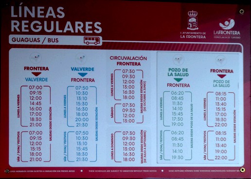
The bus connections are insufficient. Internet timetables
only show the current connections - preliminary planning is difficult.
The island is less recommended for swimmers.
There are only a few places where it is safe to swim. (E.g. Tamaduste, La Restinga).
An alternative are natural sea pools - very idyllic, but more comparable to a hotel pool for swimming.
Arrival
Tourists mostly come (not very eco-friendly) with the local
airline Binter from Tenerife or Gran Canaria.
It is also slower and more expensive to travel by ferry.
ATTENTION when arriving via Tenerife: International flights reach
Tenerife via Tenerife South (TFS), the onward flight to El Hierro
takes place via the domestic airport Tenerife North (TFN) (at the other end).
At the airport in El Hierro, two rental car companies (CICAR and PLUSCAR)
have lots of cars and an office - CICAR is offering the cheaper rates.
The island is divided into 3 regions Valverde, Frontera and El Pinar.
IMPORTANT: There are only three petrol stations, one per region: Valverde, Frontera and El Pinar.
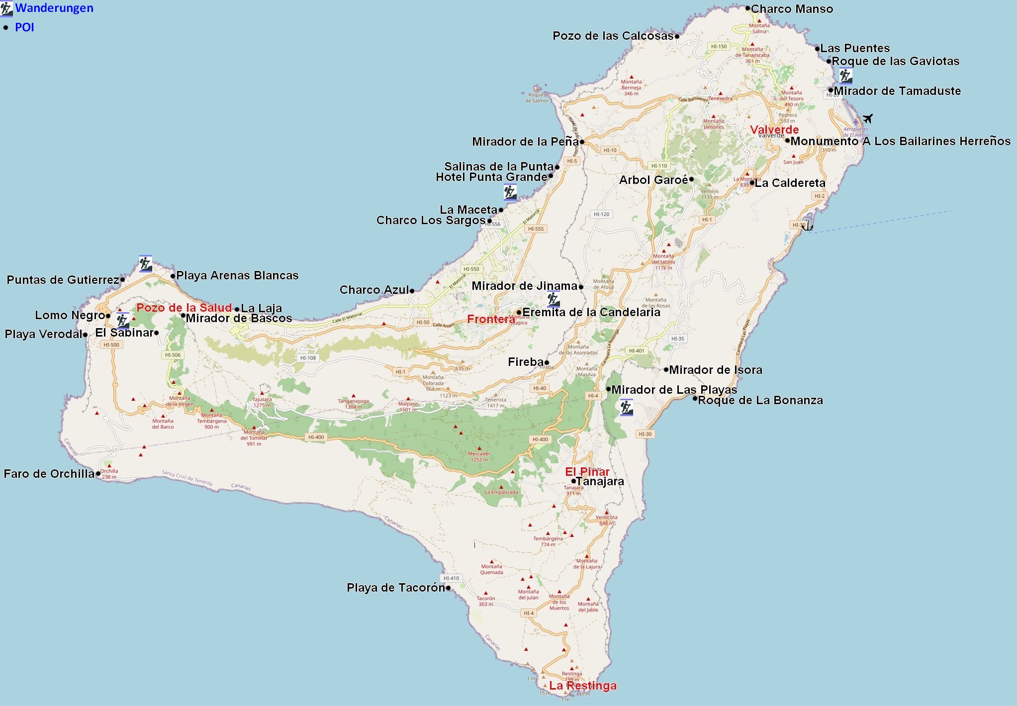
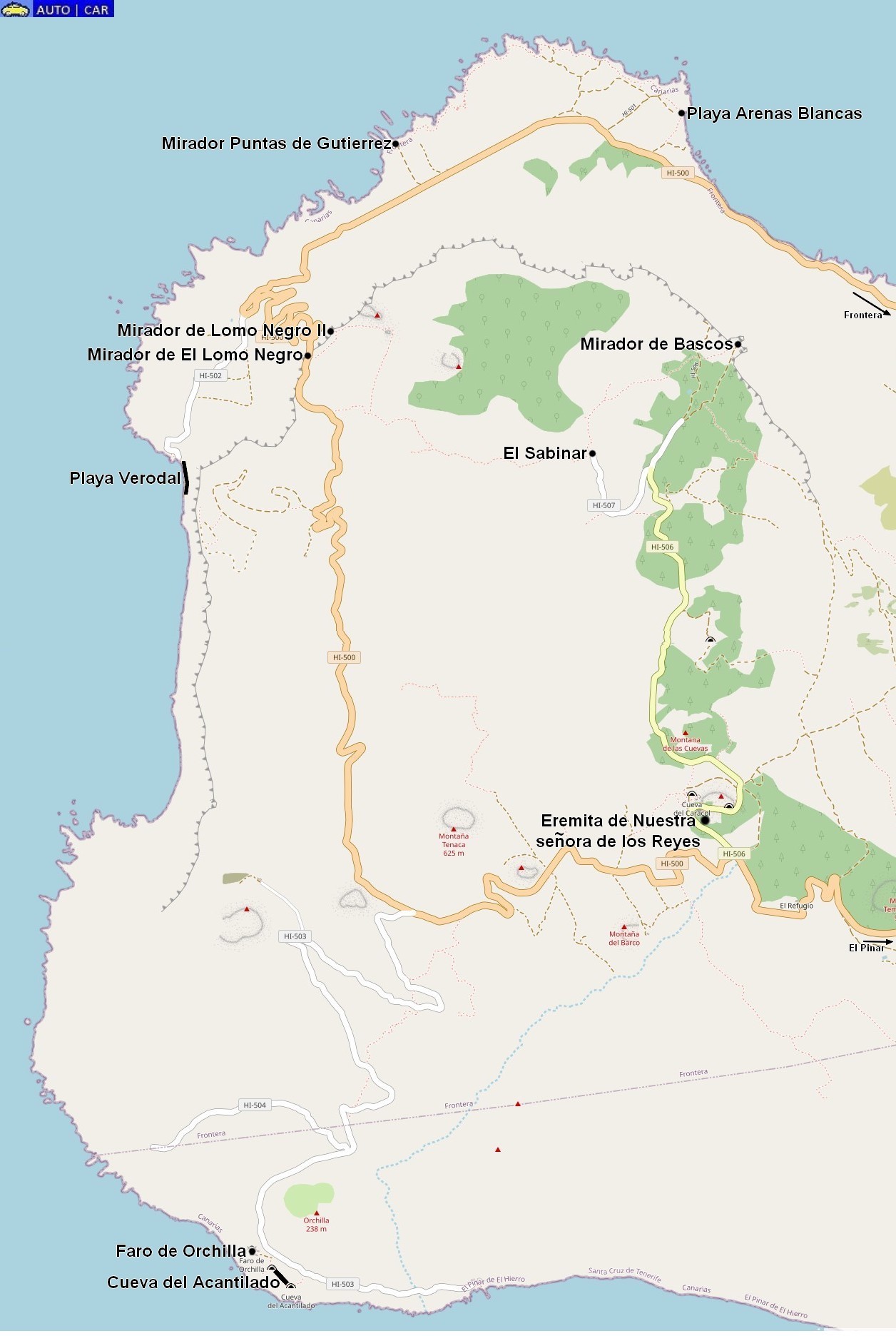
Overview
The main viewpoints of the whole island are marked in the overview plan:
EL GOLFO
Most of the miradores can be found in the municipality of Frontera (⭐ El Golfo region). This area can be found in the general plan in the northwest of the island.
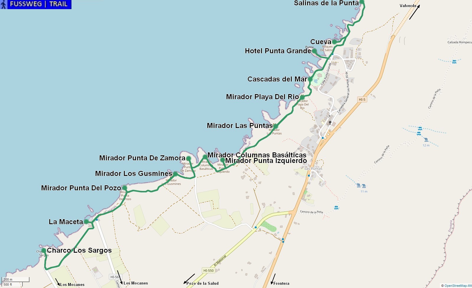
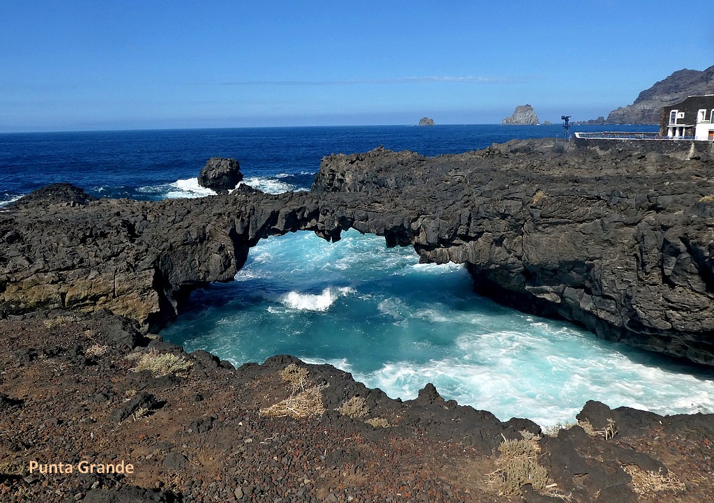
The northern part from Salinas de la Punta to Charco los Largos is accessible on foot,
whereby the path between the Hotel Punta Grande (according to the Guinness Book of Records,
»smallest hotel in the world«) and La Maceta is easily accessible with wooden boards.
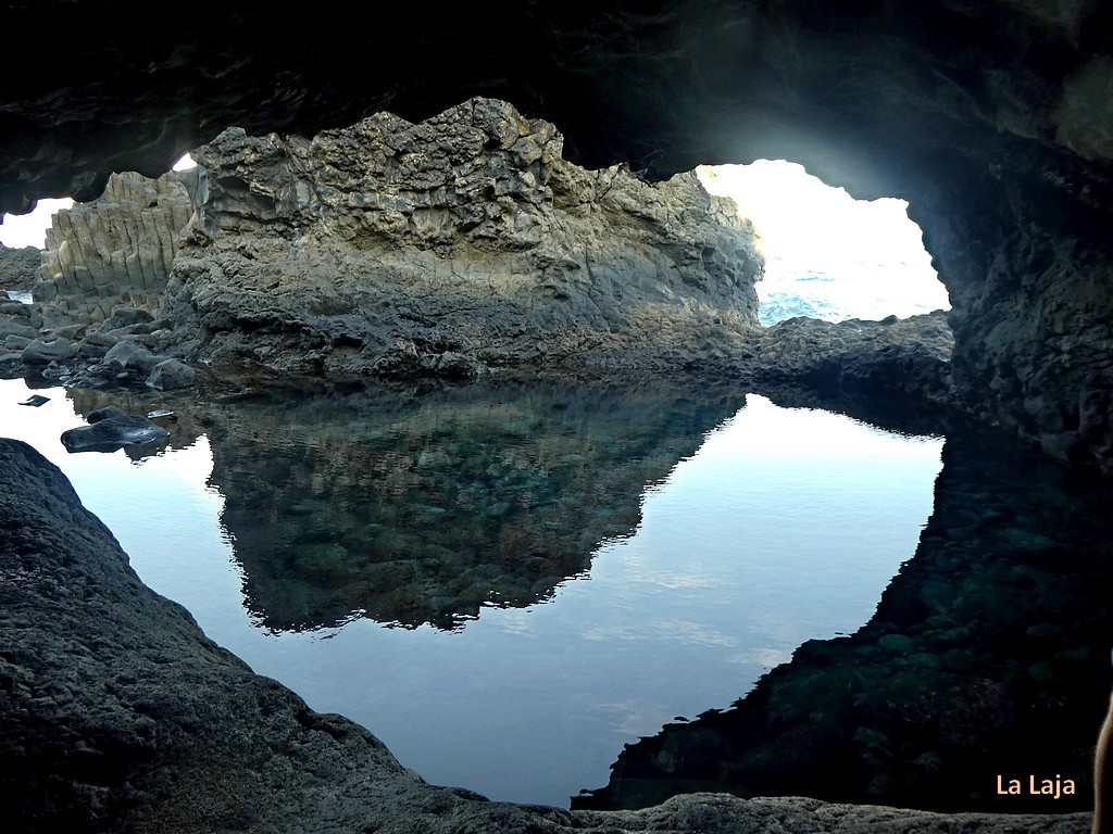
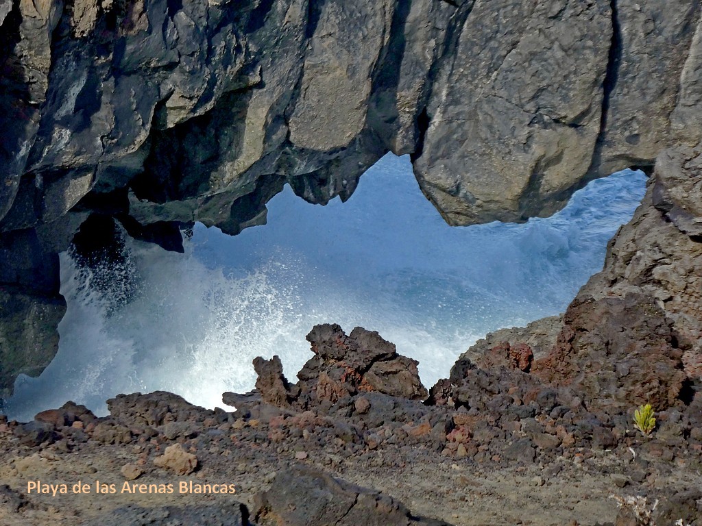
Between the Salinas and the Hotel Punta Grande there is an unmarked cave that should not be missed.
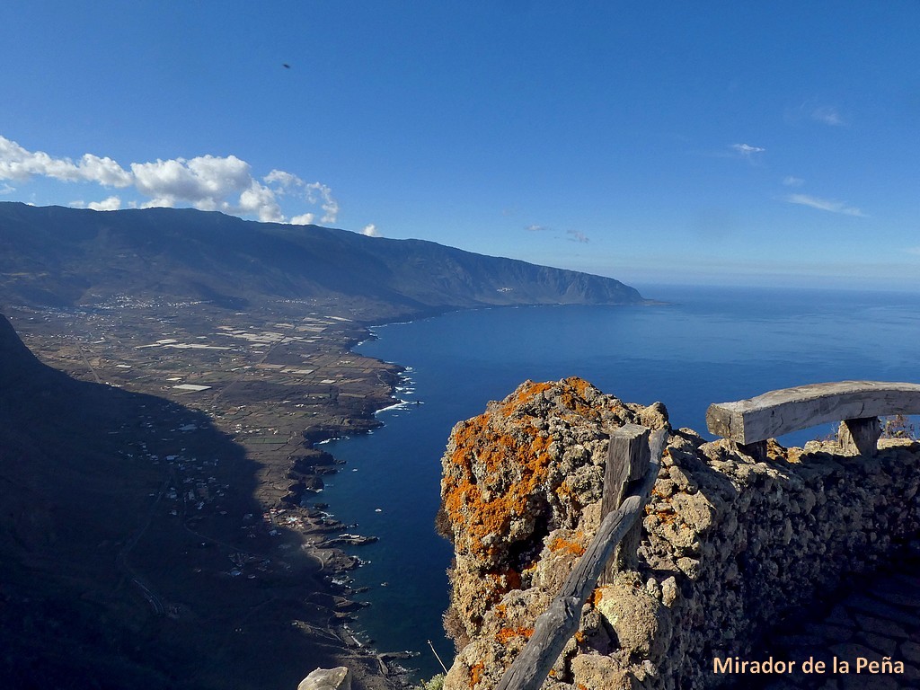
⭐ Mirador de la Peña: This mirador is almost 1000 meters above the coast and belongs to another trip.
From the Mirador de la Peña you can only walk down to the ⭐ Roques de Salmor.
There is no road or walkable path along the coast.
The rock group is one of the landmarks of El Hierro. You can see them
in every prospectus and from all west facing miradores and also from many places on the coast.
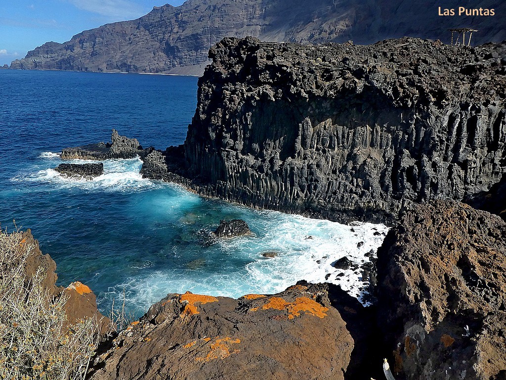
You start the walk in Las Puntas at the Hotel Punta Grande (which, according to Guiness,
is the smallest hotel in the world). You shouldn't go too early in the
morning because then some parts will be in the shade.
There are also several restaurants in Las Puntas.
Restaurants: The density of restaurants is far lower than in the tourist
hotspots on the neighboring islands. The day of rest in many
restaurants is Monday / Tuesday. Most are open on Saturday / Sunday.
Detailed plan of the Salinas de la Punta walk to Charco los Largos:
The southern part of the El Golfo region is easy to visit by car. (⭐ Charco Azul, La Laja, Pozo de la Salud).
MAP: see general map above.
This route is also used by a public bus. The timetable must be checked on
the stop notice. In the www there is only the currently next bus.
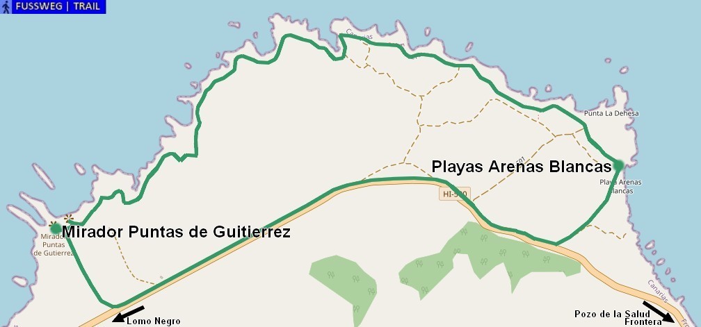
The Western Corner
In the west there is a very recommendable hike starting at
⭐ Playas Arenas Blanca to Mirador Puntas de Guitierrez.
Then there are other great sights. These can be
reached via winding roads, alternatively, for example,
the area can also be accessed on foot from Sabinosa (large difference in altitude).
⭐ Miradores Lomo Negro I & II
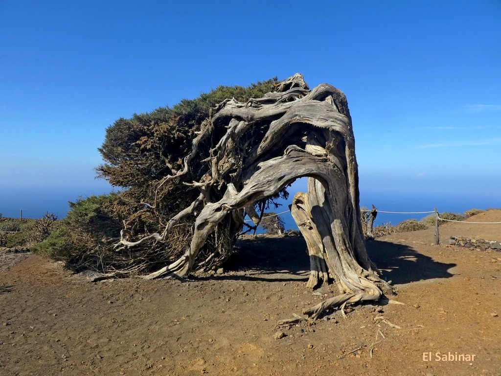
⭐ El Sabinar (overgrown juniper tree = a landmark of El Hierro)
⭐ Mirador de Bascos (currently closed - view also on the neighboring path)
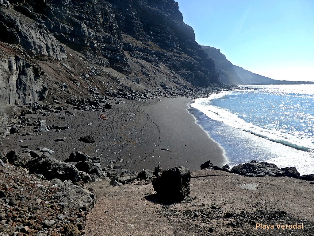
⭐ Playa Verodal (a beautiful, unsupervised sandy beach -
a rarity on El Hierro - however, as everywhere with dangerous currents)
◆ Faro de Orchilla
◆ Cueva de Acantilado - lava tunnel grotto (torch!)
ATTENTION: From Pozo de la Salud there are no more restaurants - take drinks and food with you!
The route from Eremita de Nuestra señora de los Reyes is less than a dirt road.
(Walking pace!). It is worth considering walking from Lomo Negro to El Sabinar and Mirador de Bascos.
If you live in Sabinosa or Pozo de la Salud and can find a lift
to the Miradores Lomo Negro, you can walk all the way to Sabinosa
(large difference in altitude on the descent to Sabinosa).
Exploring the west usually takes more than a day.
It depends on whether you want to do one or both of the suggested hikes
or whether you want to take a break on Playa Verodal.
The South
La Restinga is one of the few bathing destinations.
It's touristy here, something like Tenerife or Gran Canaria 20 or 30 years ago.
The place is actually a boat harbor, supplemented by a promenade
created with wooden boards and a demarcated bathing beach -
protected from waves and currents - at the western end of the place.
There is supposed to be a real natural beach a few minutes drive away in Playa de Tacuron.
La Restinga is also a hotspot for divers (diving school in town).
The place is less recommended for hikers.
After a hike in the central area of the island, a detour to La Restinga is definitely recommended.
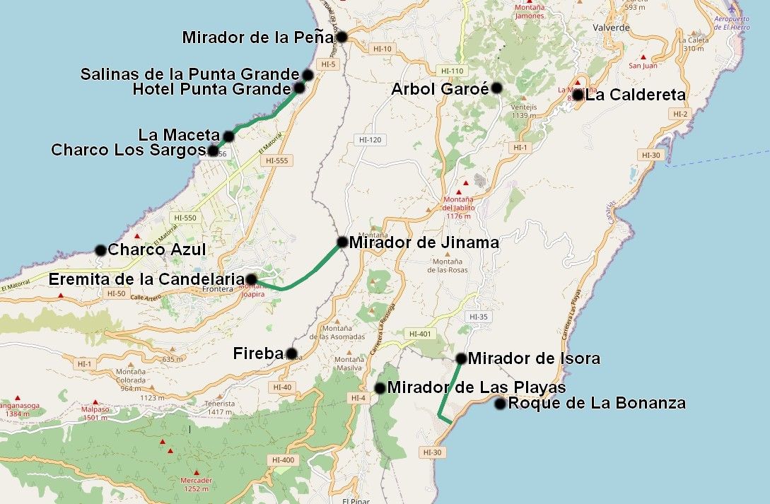
The Central Area
In the central area, these miradores are something very special and definitely worth a visit:
⭐ Mirador de la Peña
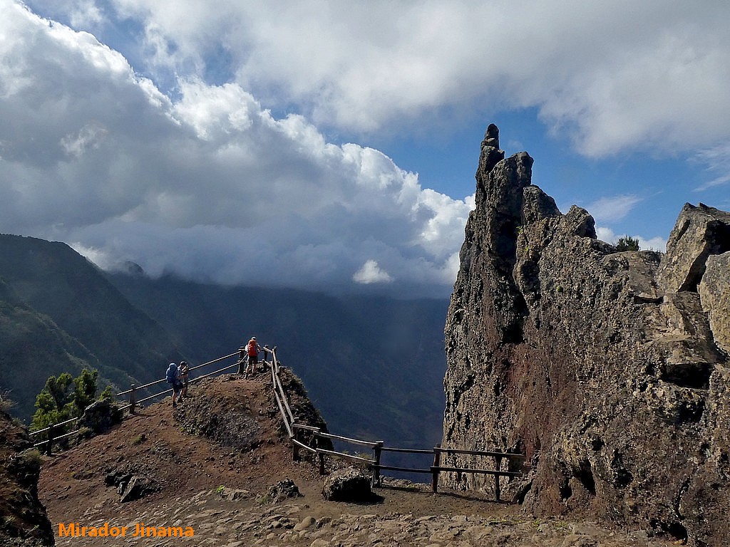
⭐ Mirador de Jinama
⭐ Mirador de Isora
⭐ Mirador de Las Playas
◆ La Caldereta (pumped storage power plant)
All four miradores offer fantastic views of the coast -
the first two on the west coast (El Golfo) and the other two on the east coast.
La Caldereta
El Hierro strives for an energy supply with renewable energy.
Wind energy from numerous turbines is mainly used for this purpose.
A pumped storage power plant (similar to Kaprun) was built
in La Caldereta for periods of calm.
However, the capacity of the system is only sufficient
for a few days, so that electricity has to be produced from diesel during a longer period of calm.
The latter is often kept secret in public relations.
As everywhere in the world, people are reluctant to mention
that the good intentions could only partially be realized.
This POI (Point of Interest) is one of the landmarks of the island:
◆ Arbol Garoé
The POIs of this region are shown in an overview map:
Two hikes are shown in detailed plans, whereby it should be noted
that each height difference of around 900 meters has to be overcome.
The first path leads from the Mirador de Jinama down to the
Eremita de la Candelaria (chapel in the middle of a volcanic hill) in Tigerday (Frontera).
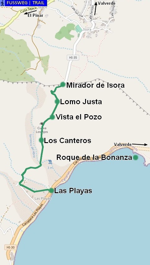
This path leads from the Mirador de Isora down to Las Playas
(the Canarios are not very imaginative when it comes to naming them) and
can be extended to the Roque de la Bonanza via the barely traveled road.
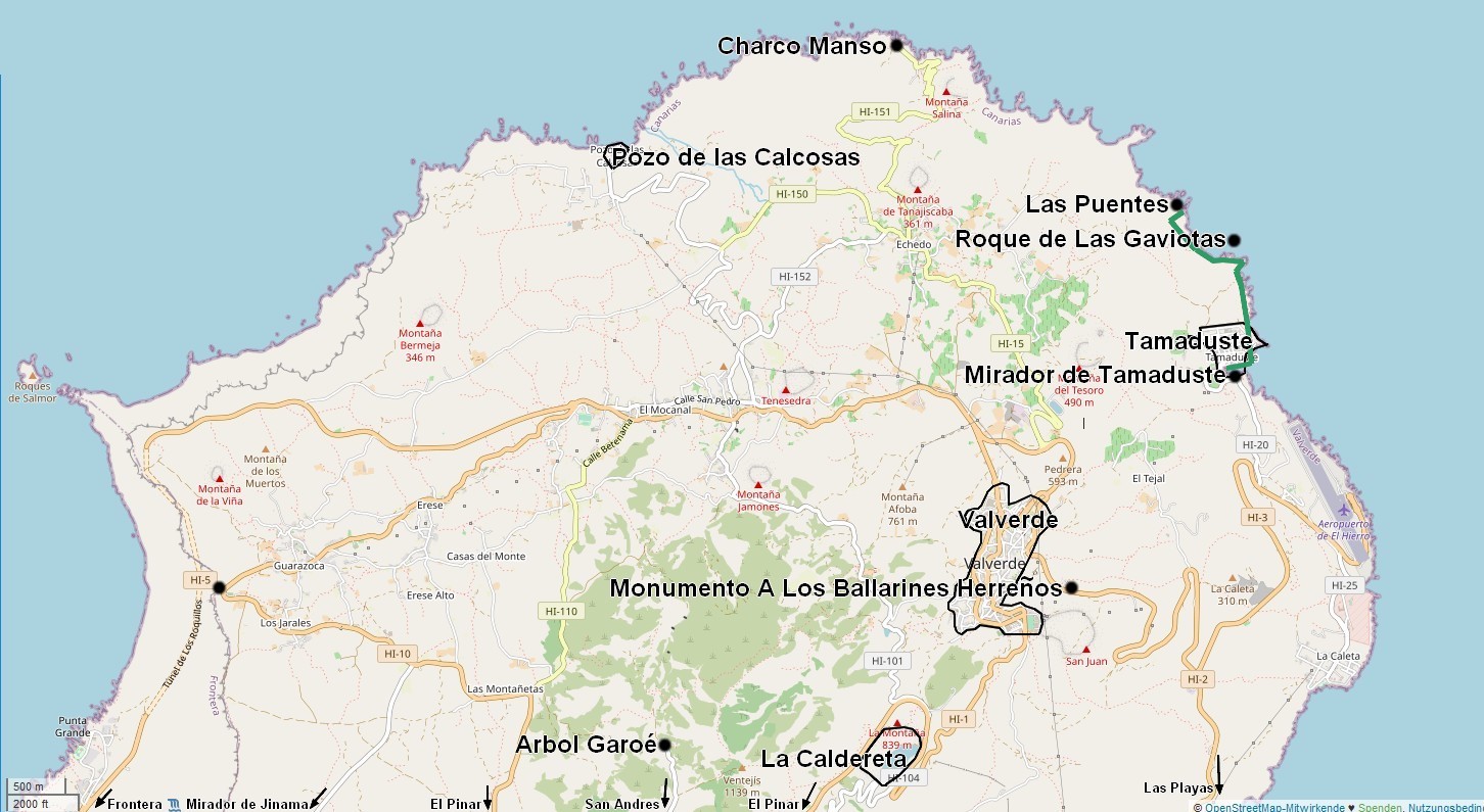
The North
The most interesting destinations in the north are:
(partial overlap with viewpoints already described elsewhere)
⭐ Mirador de la Peña
◆ Valverde
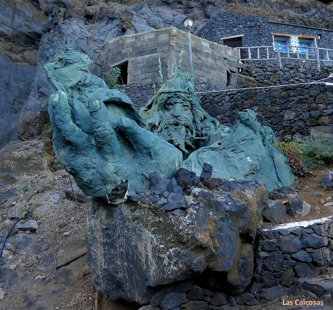
⭐ Pozo de la Calcosas
⭐ Charco Manso
◆ La Caldereta
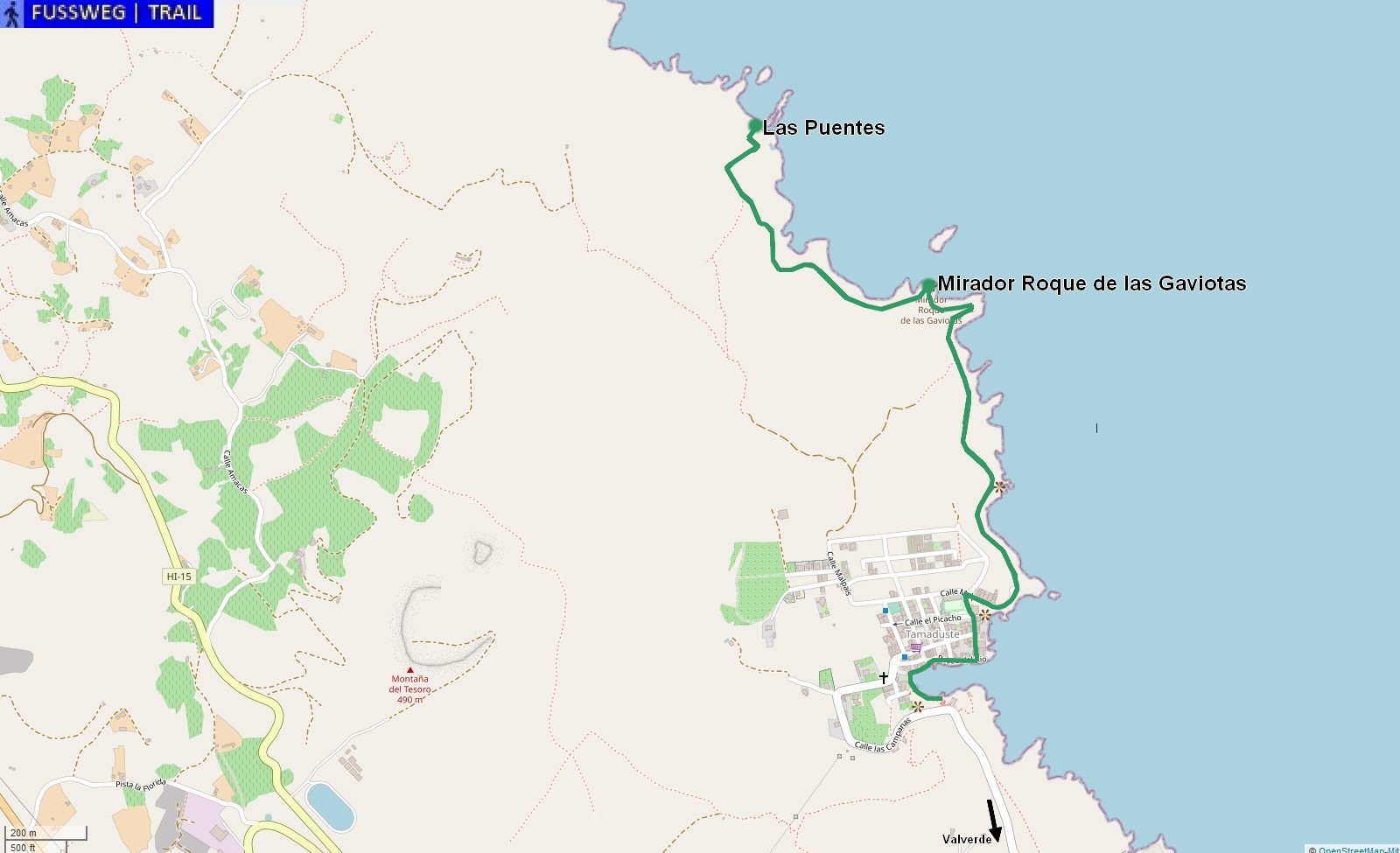
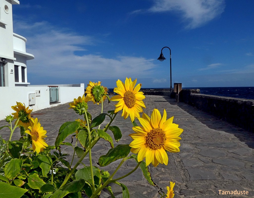
⭐ Tamaduste
The goals are shown in this overview map:
Tamaduste, with its largely protected bay, is suitable as a bathing resort and is not yet overcrowded.
⭐ A highlight is the stretch of coast north of the town. A hike that is a must.
Similar to the hike in the far west, it goes here over a rocky path along the
picturesque coast from one vantage point to the next.
Here is a
rough drawing of the recommended hike:
In any case, the hike should include the village of Tamaduste and the really pretty bay.
Tamaduste is also suitable for a few days of relaxation
(good opportunity to swim safely in the sea).
Pics
Wishes, suggestions, criticisms or simply comments to derNachdenker@gmx.at
The contents of these pages have been carefully compiled,
but errors may still be included, for which the author assumes no liability.

 △
△