Gran Canaria is not only sandy beach and dunes, there are numerous excursions that should not be missed.
Main interests: beach holiday, natural beauties, hikes, caves, old towns with flair, no(!) museums
Recommendations
for car routes and hikes
Note on the maps: All small maps can be displayed bigger in a new window using the context menu (right mouse button).
Recommendations:
Meals
In the tourist areas (beaches) the food is as expected.
Spanish, Canarian and food for German vacationers.
Inland, one should be careful with beef:
The quality does not correspond to Central European ideas, and it is also expensive.
Car route 1
Map
Mundo Aborigen
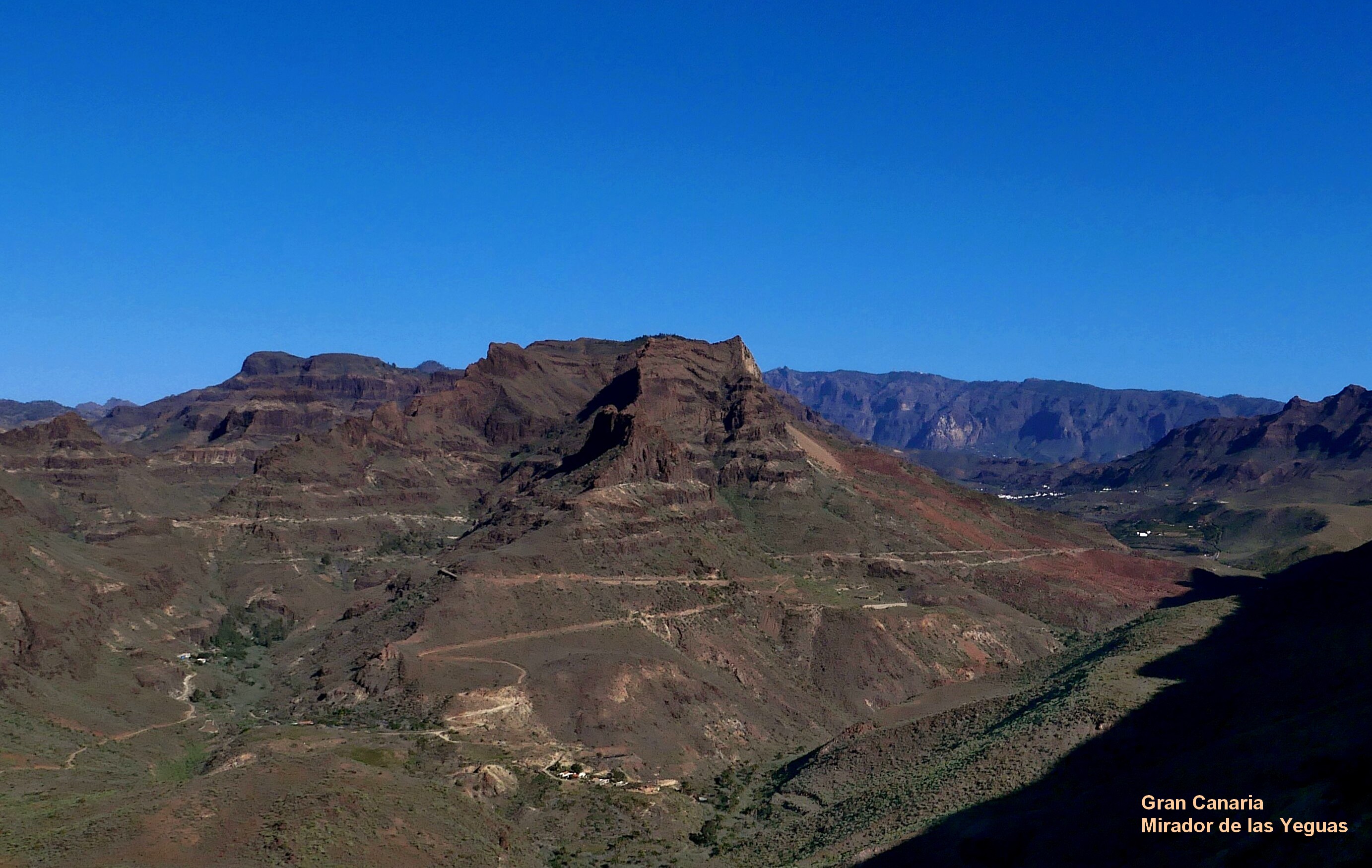
Mirador de Yeguas
Arteara
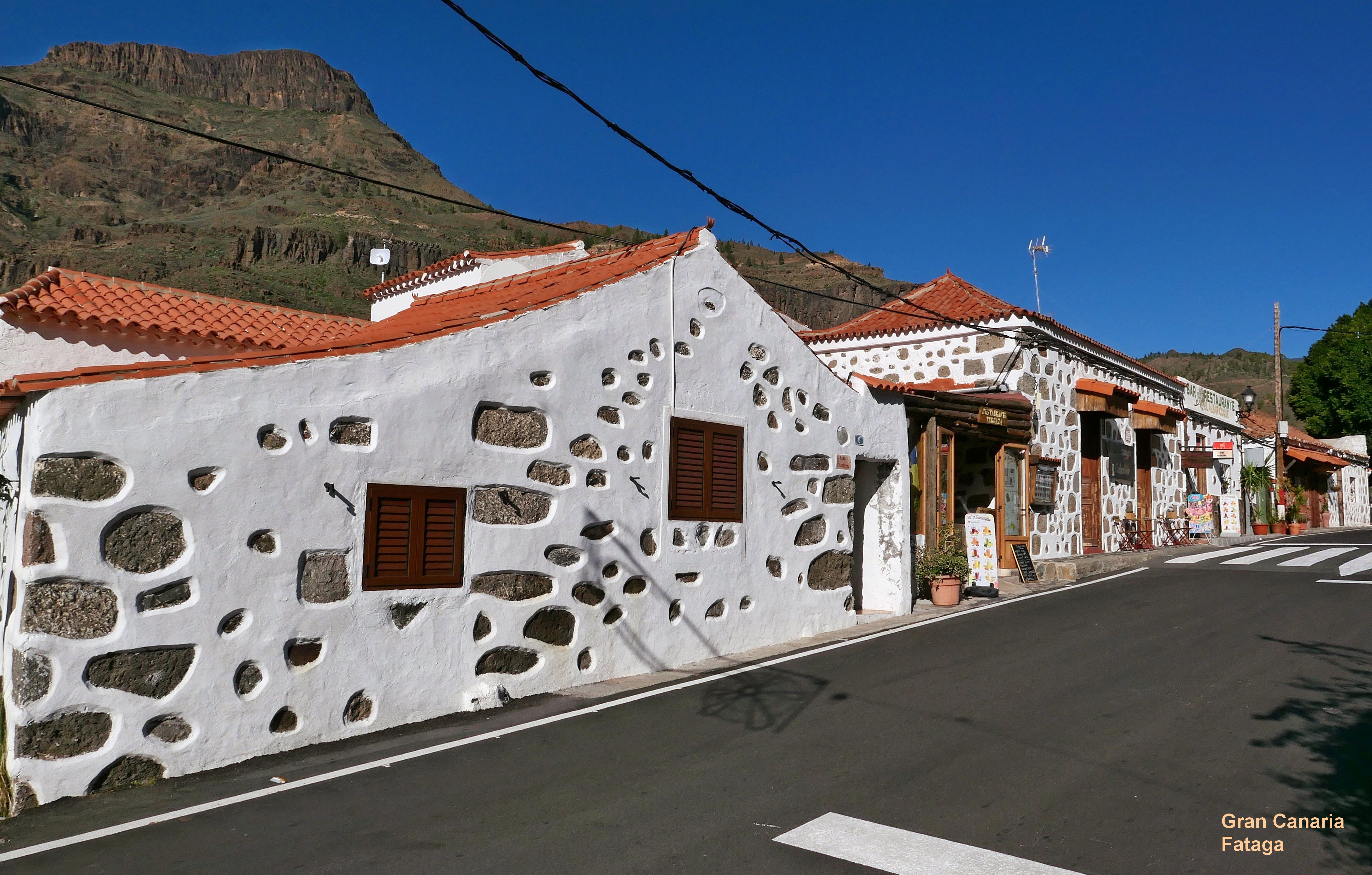
Fataga
San Bartolomé de Tirajana
Mirador Degollada de Cruz Grande
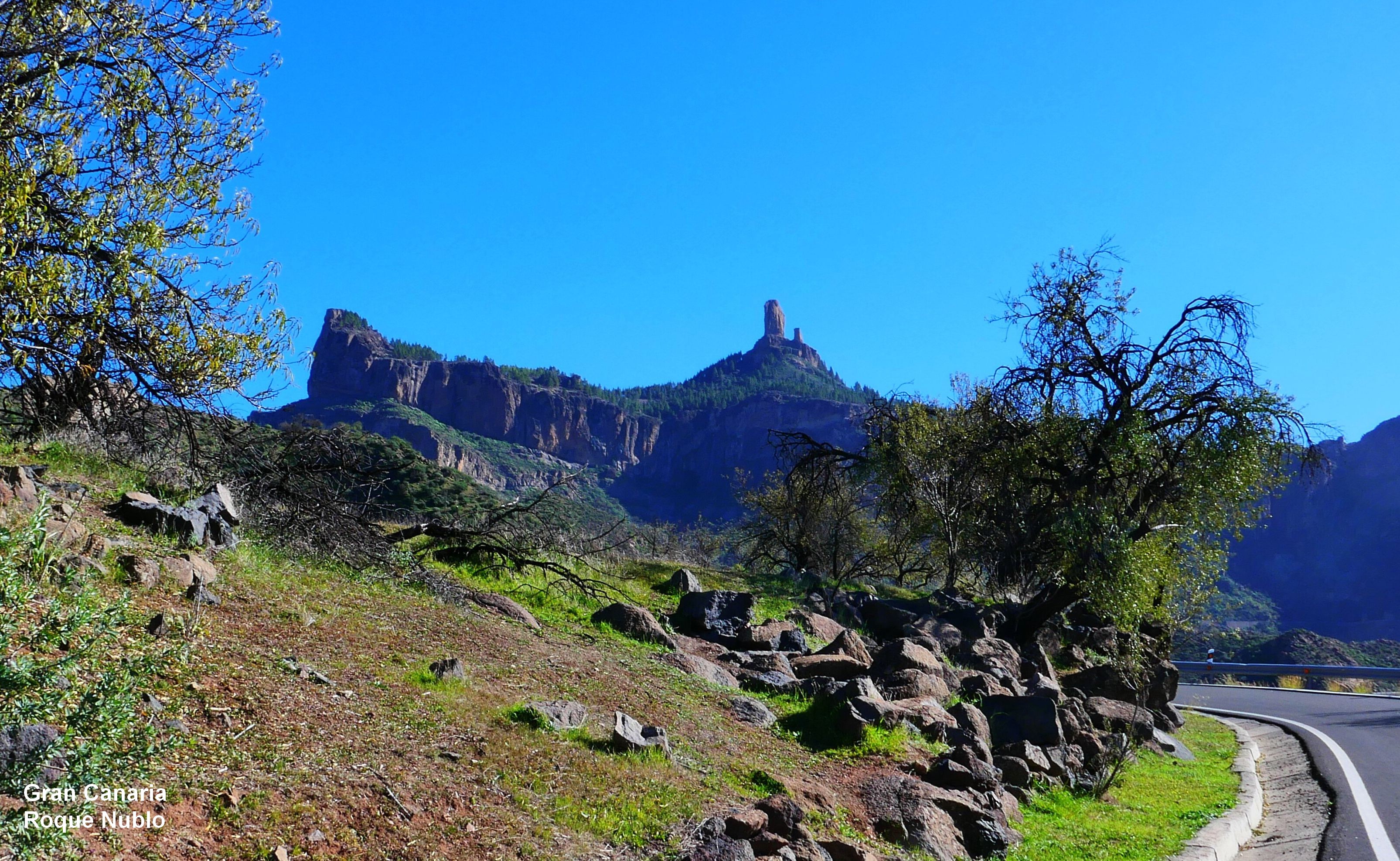
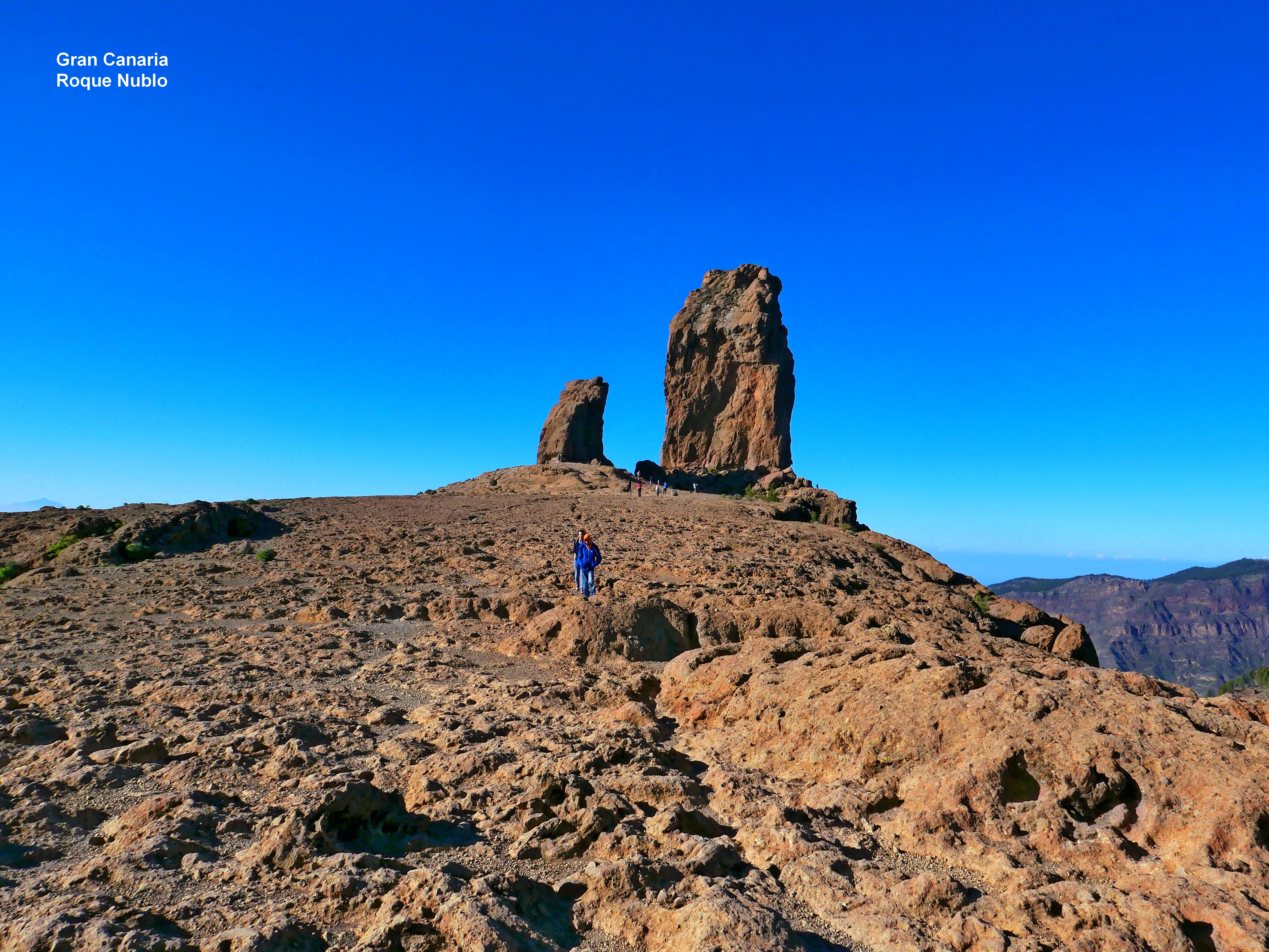
Roque Nublo
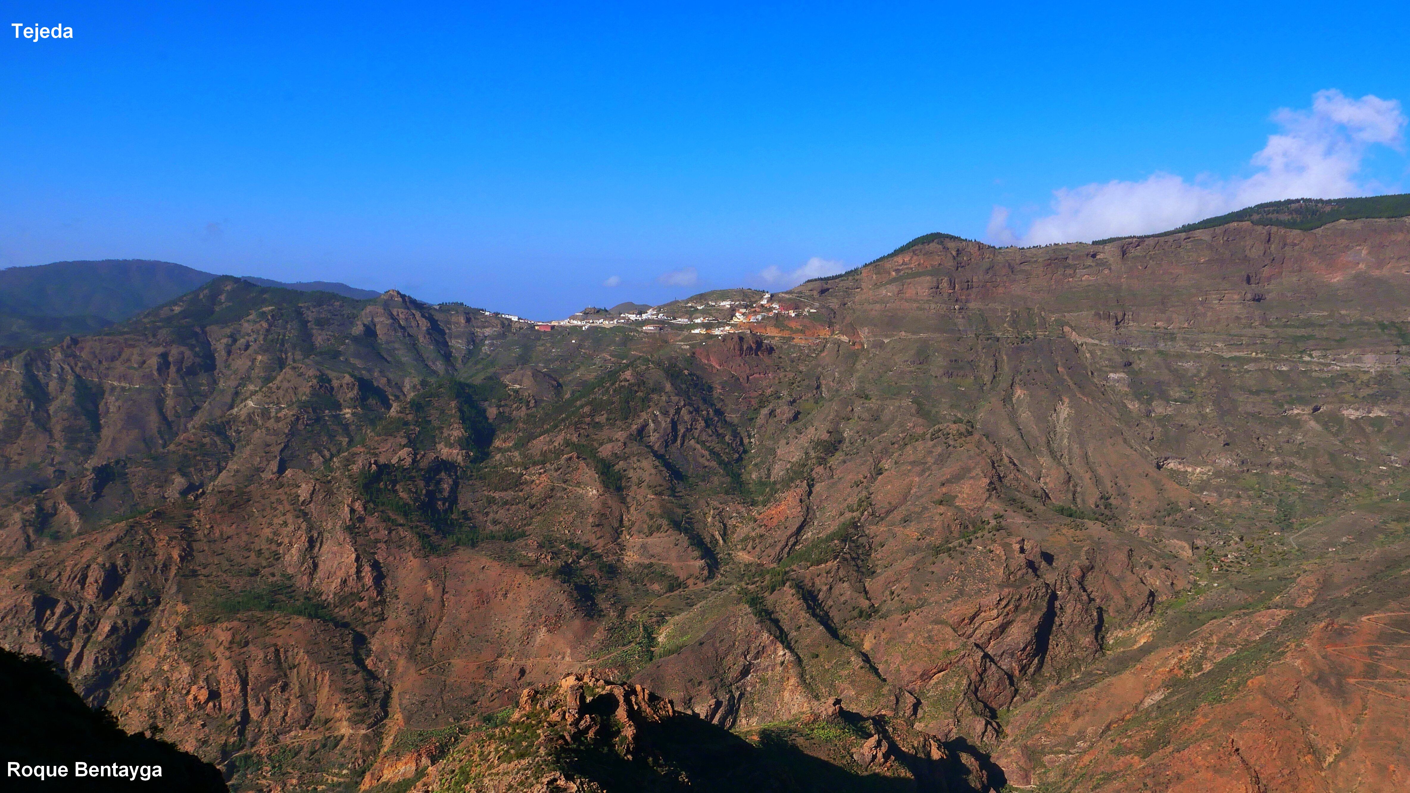
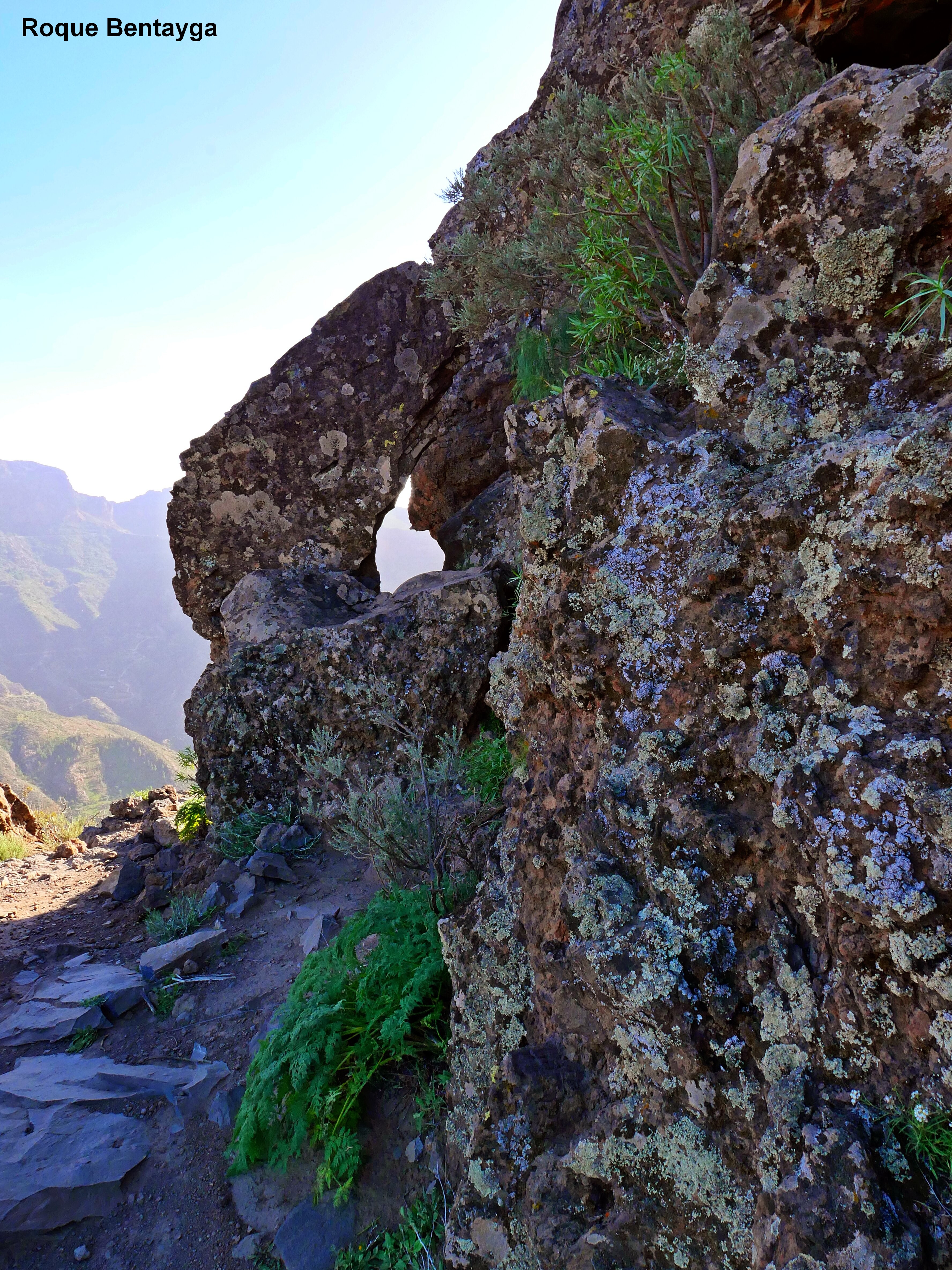
Roque Bentayga
Tejeda
Tejeda (detail)
This route can be easily combined with 1 - 2 hikes.
From Maspalomas/Playa del Inglés, where most holidaymakers live, the GC-60 leads north.
The road meanders in countless turns to Tejeda. (Travel time with a few stops 1.5 hours).
In the very south you pass Mundo Aborigen and Arteara with old Canary sites (necropolis),
which in my opinion are only moderately interesting. In between, a stop at the Mirador de las Yeguas is recommended.
In any case, Fataga is very, very worth seeing, a small, idyllic place with numerous restaurants (nice views). The next stop worth seeing is the Mirador de Fataga with a large viewing terrace.
Further north is the provincial capital of San Bartolomé, which is also worth a stroll (including beautiful views). North of Ayacata, a dead-end road GC-600 turns to Roque Nublo (1813 m above sea level). The approximately two-hour hike (Map) should not be skipped. It is important to climb up to rocks first and then go clockwise around the rock because there are no signposts in the opposite direction.
A little further north on the GC-60 is the turnoff to the left to Roque Bentayga (1412 m above sea level), which can be easily reached from the visitor center using GC-607 and GC-671 (map). A tether is available for the last few meters of the steep ascent. (walking time approx. 1 hour)
The next and most important place in the mountains is Tejeda with beautiful views to the south and numerous restaurants and cafes. Everything is clean prepared for tourism.
Tejeda is the central place for various hikes in the high mountains.
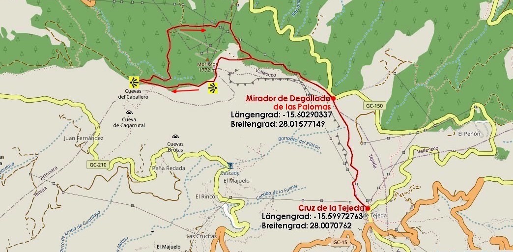
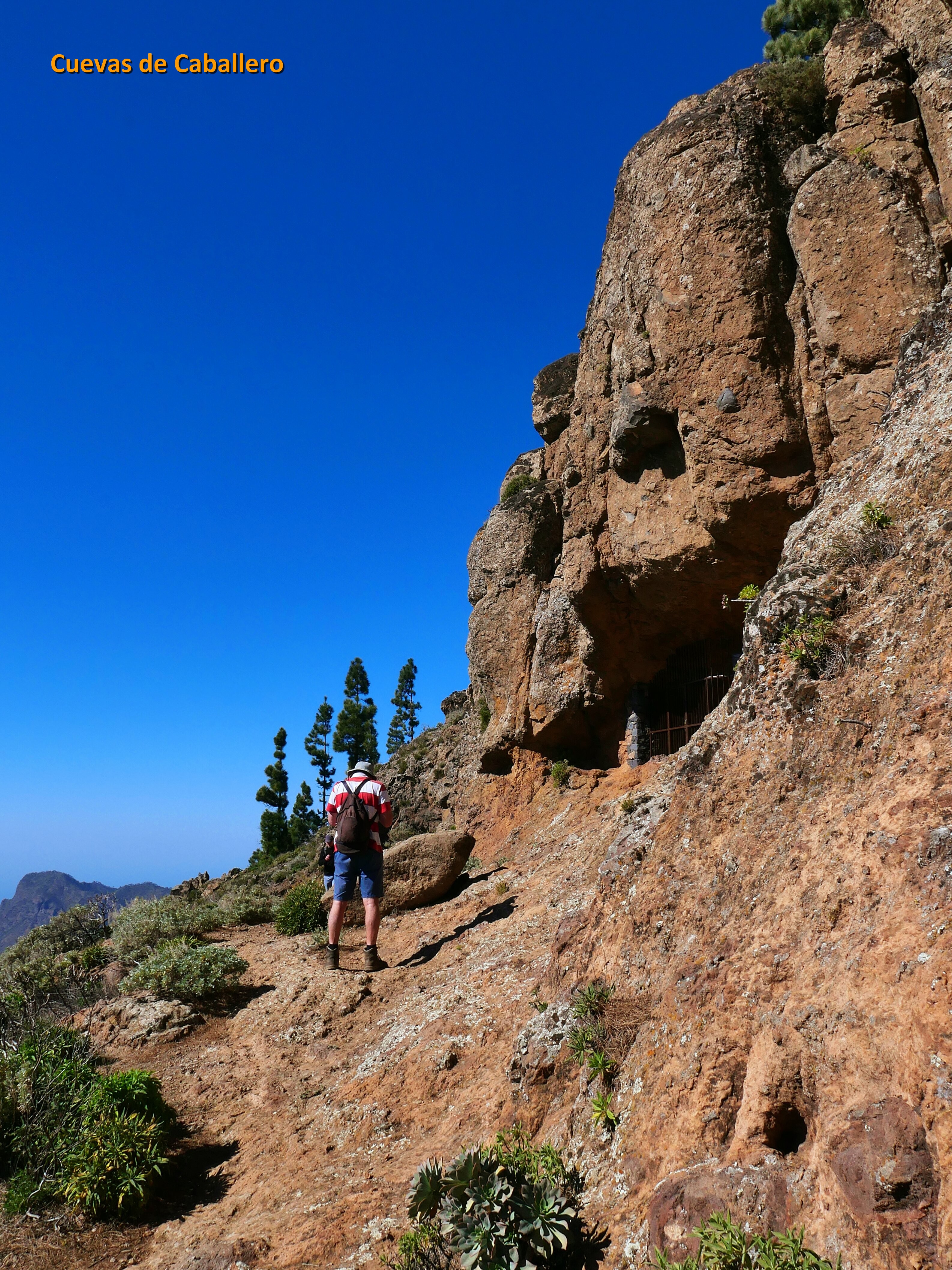
Northeast of Tejeda is the Cruz de Tejeda, starting point for numerous hikes. These hikes usually require a separate day or at least half a day. Example: A hike from Cruz de Tejeda leads via the Mirador de Degollada de las Palomas to the Cuevas del Caballero (Map).
Car route 1a
Map
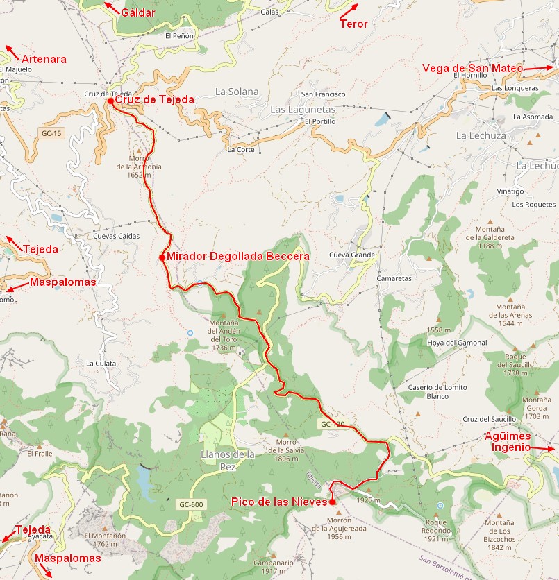
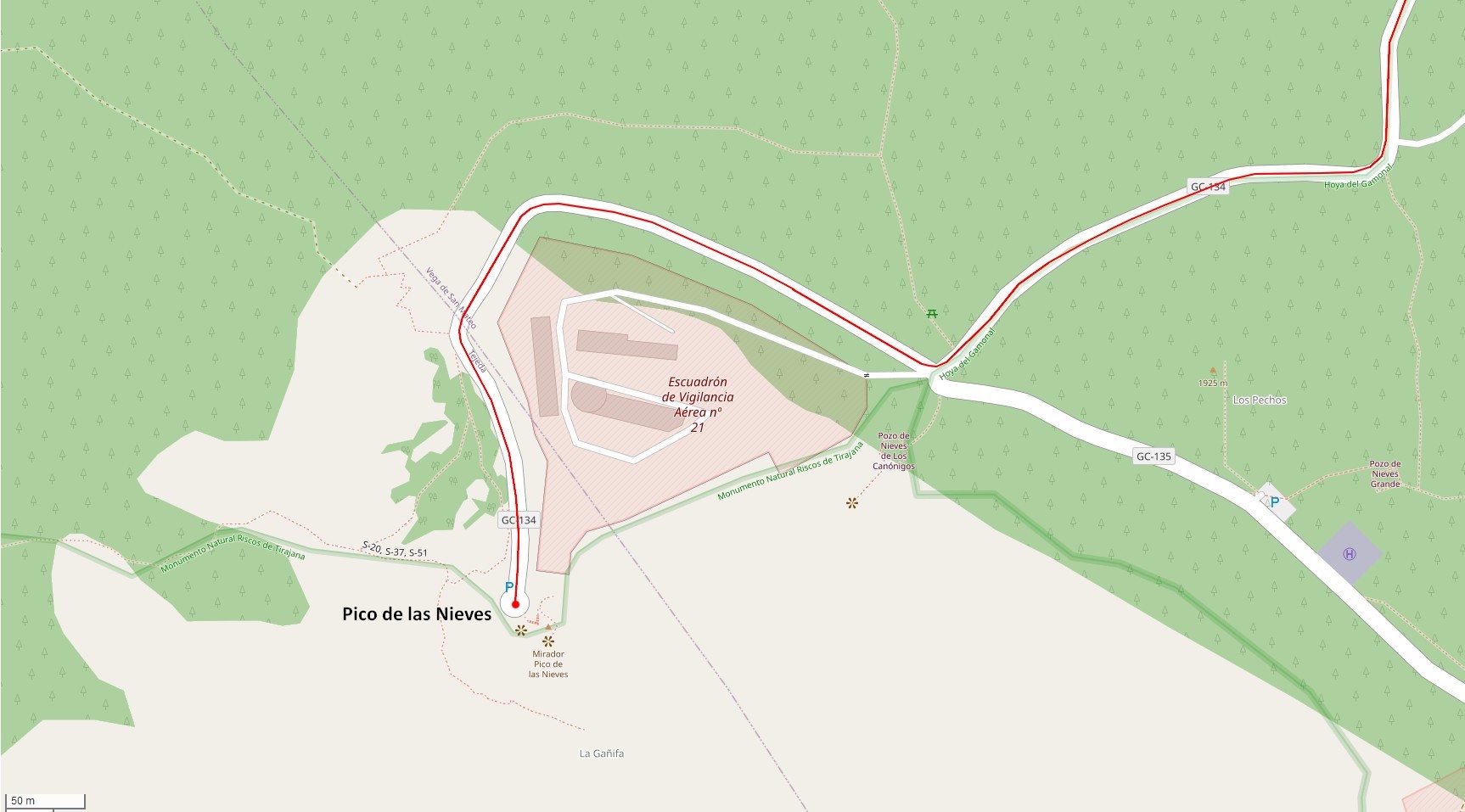
From the Cruz de Tejeda on the GC-150 south you get to the Mirador Degollada de la Beccera (better visibility in the morning with the sun behind you). Then there is a car route up to the highest point of the island, the Pico de las Nieves (all-round view from the rocky peak). To continue, you can also go in the direction of Teror and Agüimes.
Pico de las Nieves
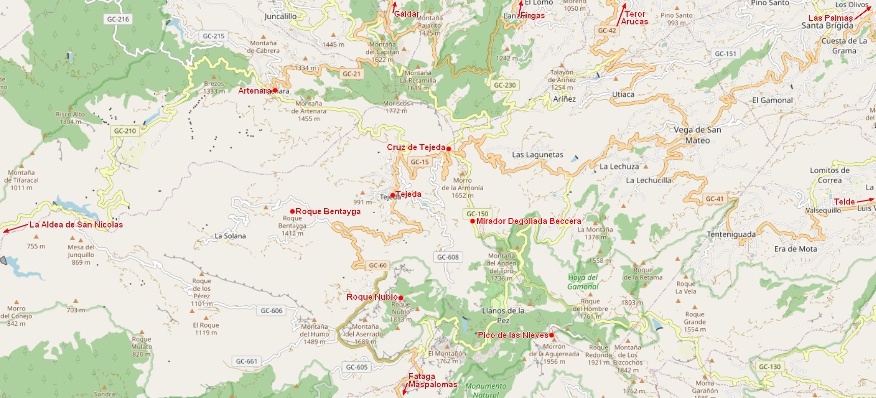
Central Overview Map
Tejeda, Arteara, Roque Nublo, Roque Bentayga, Cruz de Tejeda
Direction arrows to Teror, Arucas, St. Brigida, Vega de San Mateo, Maspalomas, Fataga, Aldea, Galdár
Map
Car route 2
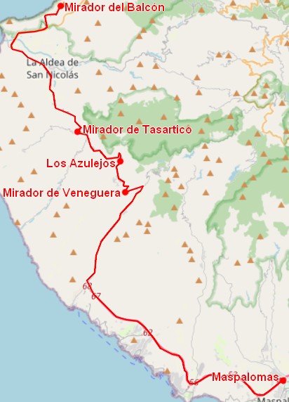
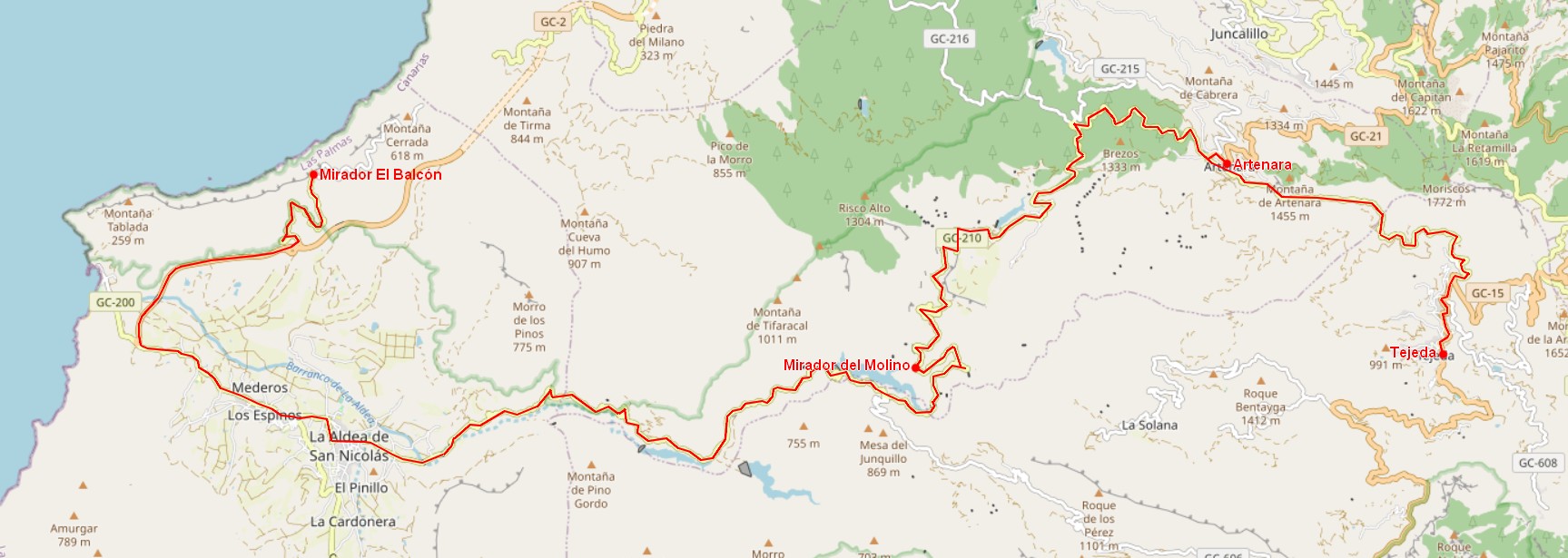
Mirador del Balcón, Arteara (2 combined maps)
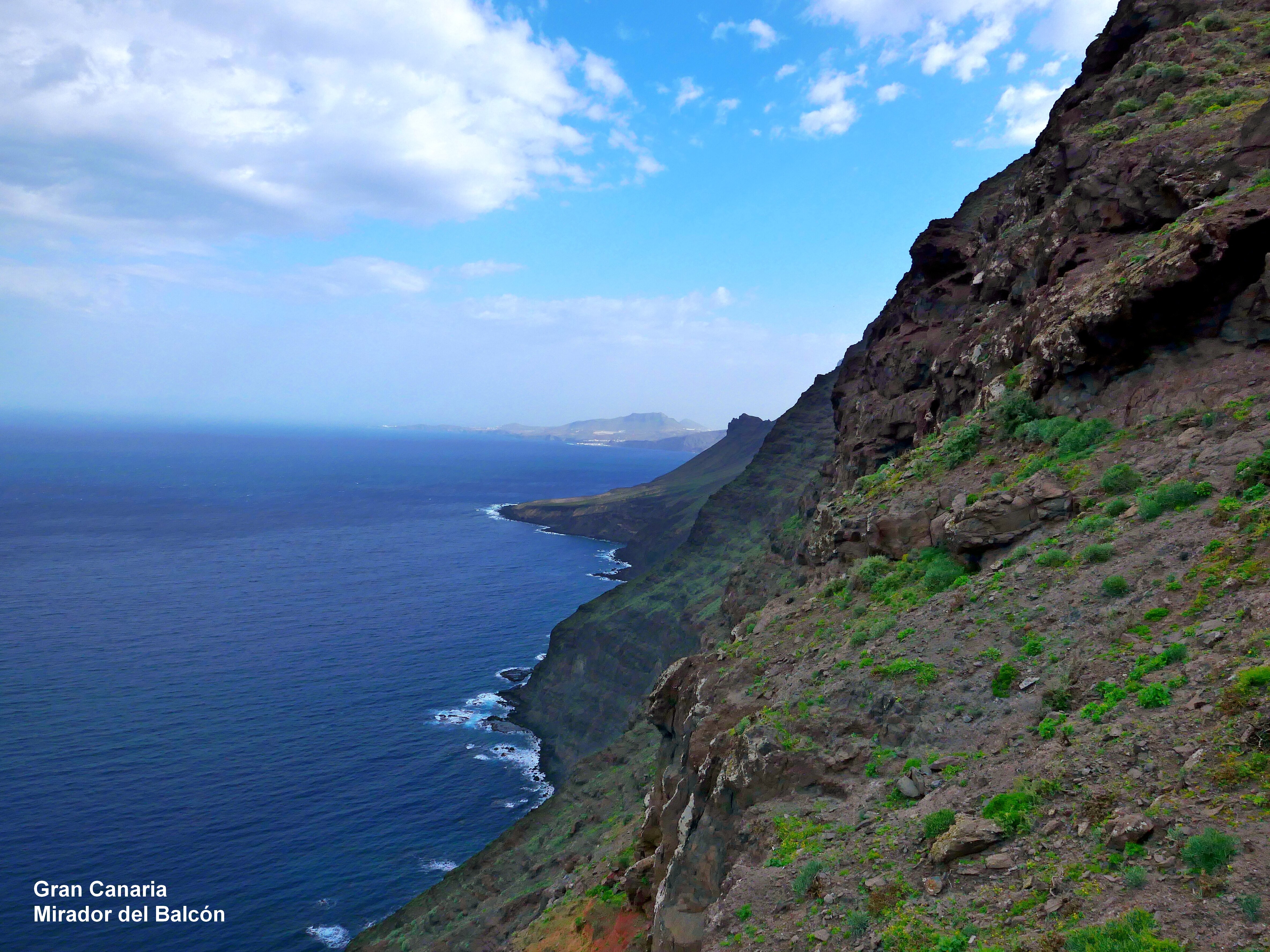
On the GC-1 then GC-200 (Puerto Rico, Mogan) you reach La Aldea de San Nicolás. Halfway there is a Mirador on the left that is worth seeing, but it cannot be approached correctly from this direction. You must (with due caution) ignore the traffic rule or approach from the west. The onward journey to the Mirador de Balcón GC-2 junction Andén Verde GC-200 is worthwhile.
Route 2a
Route 2b
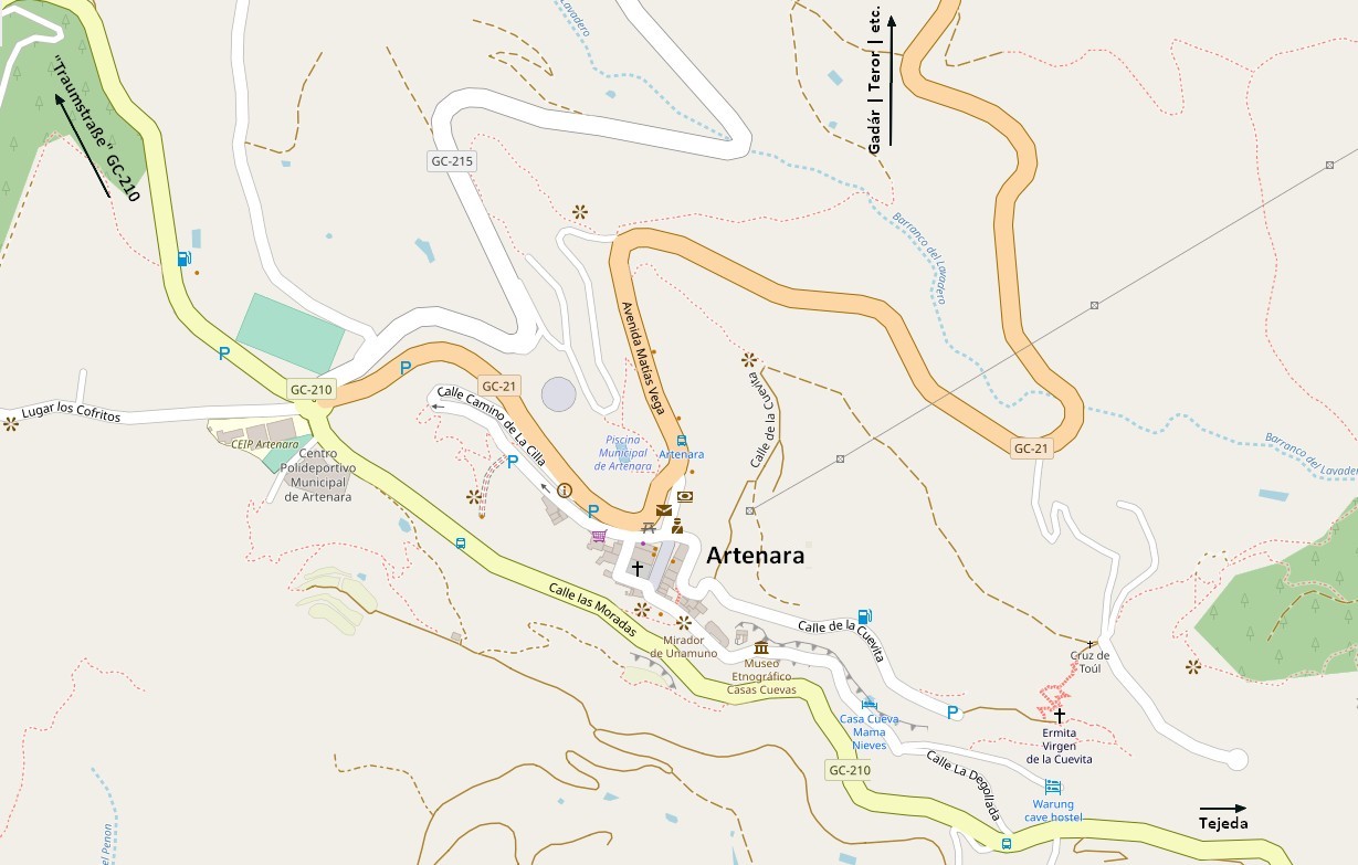
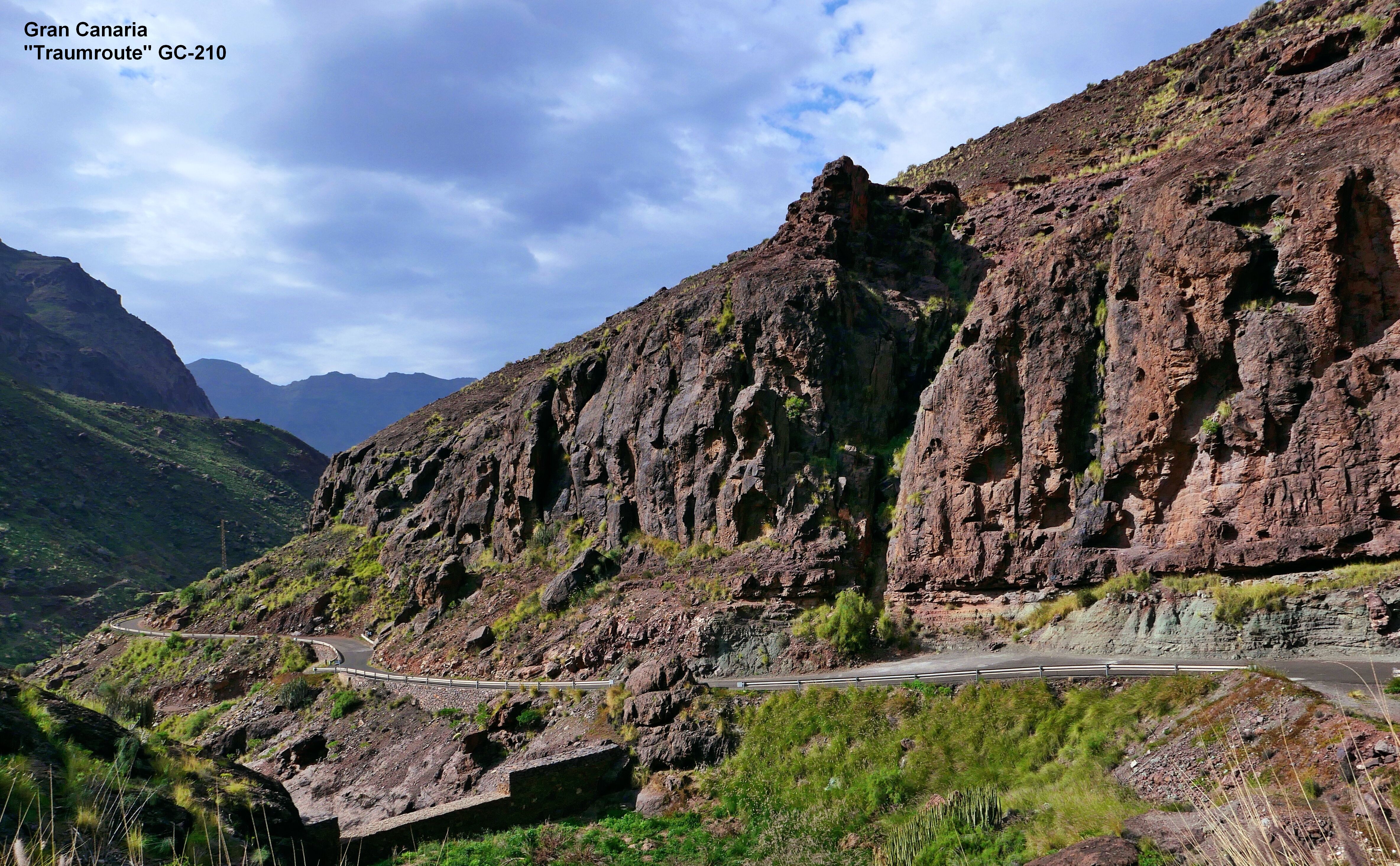
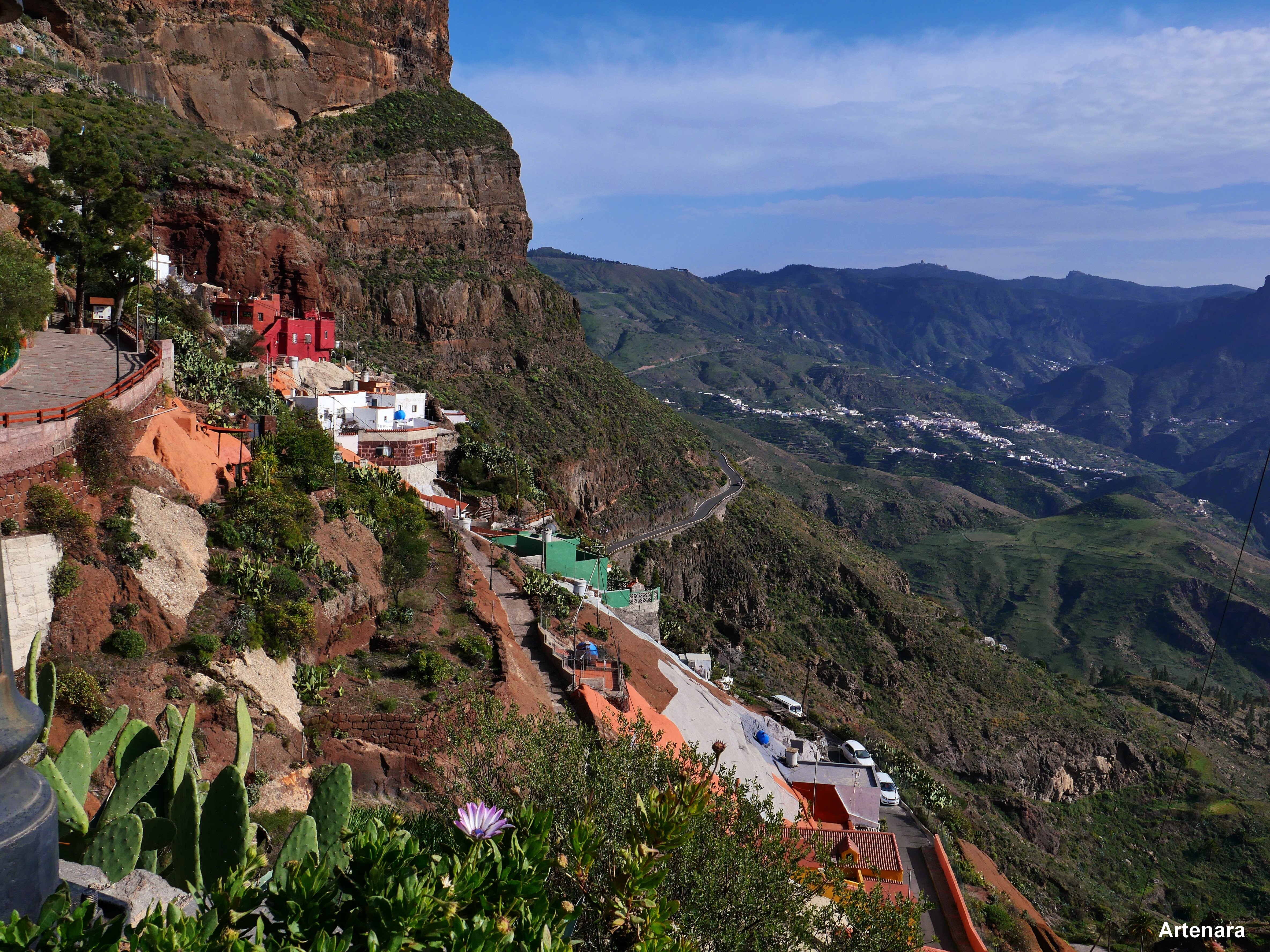
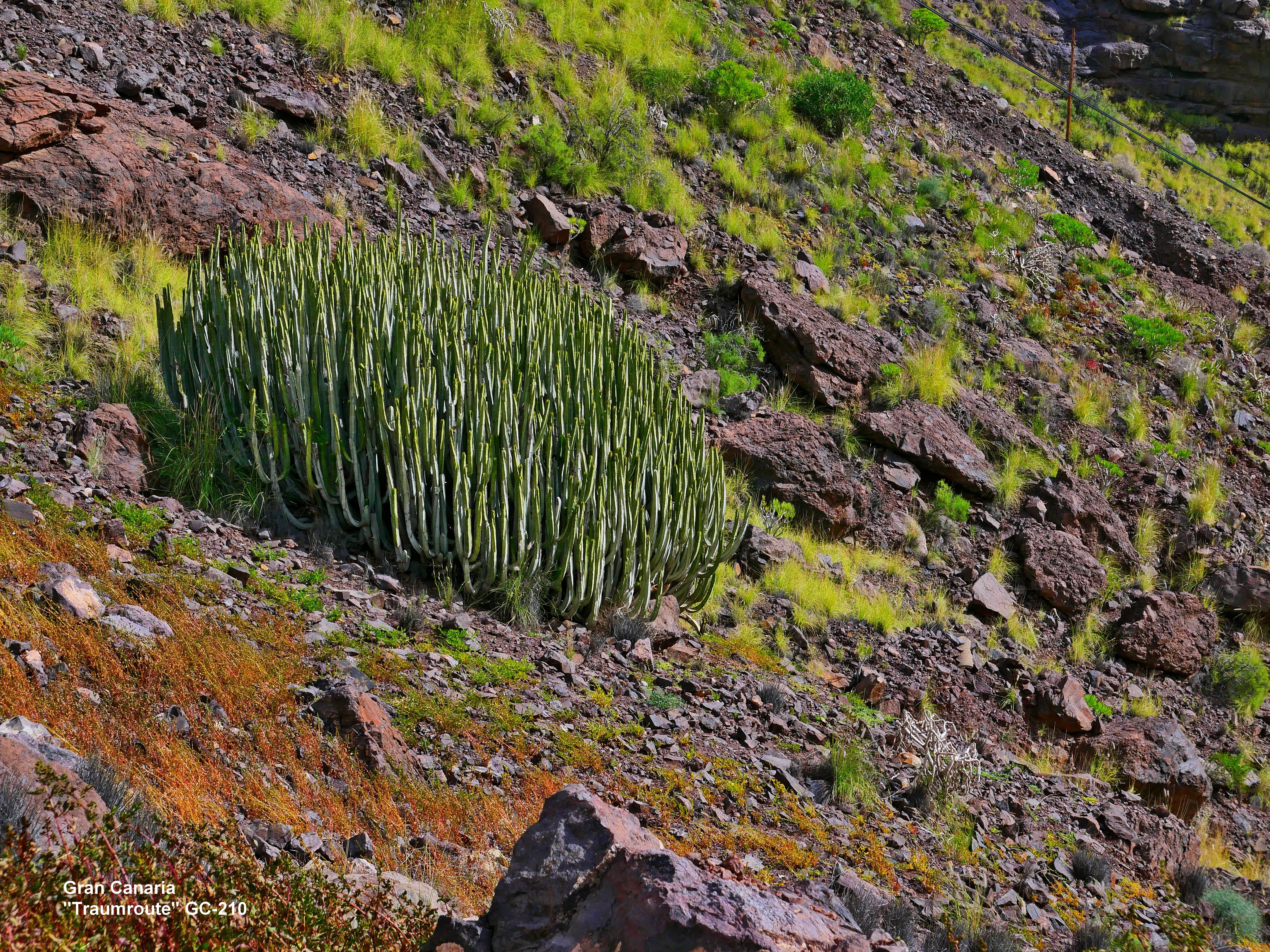
The highlight of this excursion begins when you return to la Aldea. From here begins the panoramic road GC 210 (plan second part) along the Barranco for which you should plan at least 2 hours). When driving from west to east, great views of mountains, gorges and reservoirs open up again and again, until you finally reach Artenara - the highest point on the island (1380 meters above sea level). From Artenara you can continue on the GC-210 to Tejeda and continue on a different route.
Artenara
GPS
For all trips on Gran Canaria it is advisable to take a detailed paper map with you. You cannot rely on the various GPS services. There are navigation systems that only know the main towns (all sub-towns do not appear). Others have coded more places but no street names, so that you cannot find the hotel, for example. Especially when driving from La Aldea de San Nicolas to Artenara, some providers do not show the GC 210 that connects these two places at all. Although this road should definitely be visited, the navigation system suggests a detour of 35 kilometers. With the navigation system, which knows the street, there is also the fact that the access from La Aldea de San Nicolas to the Barranco is structurally very confusing, which meant that we ended up on an unpaved side street and would not have found our way out again without the cooperation of the residents .
Another problem is the unimaginative naming of the Spaniards for example Barranco de Guayadeque and elsewhere another valley Barranco Guayadeque. It can also happen that you enter a street name and you are sent to a street in Barcelona.
Here are the coordinates of the places mentioned in the text:
Playa del Inglés
27.74736°N
-15.57665°O
Maspalomas
27.73526°N
-15.59890°O
Mundo Aborigen
27.81238°N
-15.58258°O
Mirador Degollada de las Yeguas
27.81930°N
-15.57938°O
Arteara
27.84890°N
-15.56730°O
Fataga
27.88771°N
-15.56402°O
Mirador de Fataga
27.90687°N
-15.56885°O
Mirador Monte Propre
27.92118°N
-15.57453°O
San Bartolomé de Tirajana
27.92541°N
-15.57298°O
Mirador Degollada de Cruz Grande
27.92944°N
-15.59830°O
Mirador Degollada de las Palomas
28.01598°N
-15.60321°O
Cuevas del Caballero
28.01678°N
-15.62027°O
Mirador Degollada Beccera
27.98884°N
-15.59335°O
Pico de las Nieves
27.96191°N
-15.57176°O
Mirador de Veneguera
27.89658°N
-15.72211°O
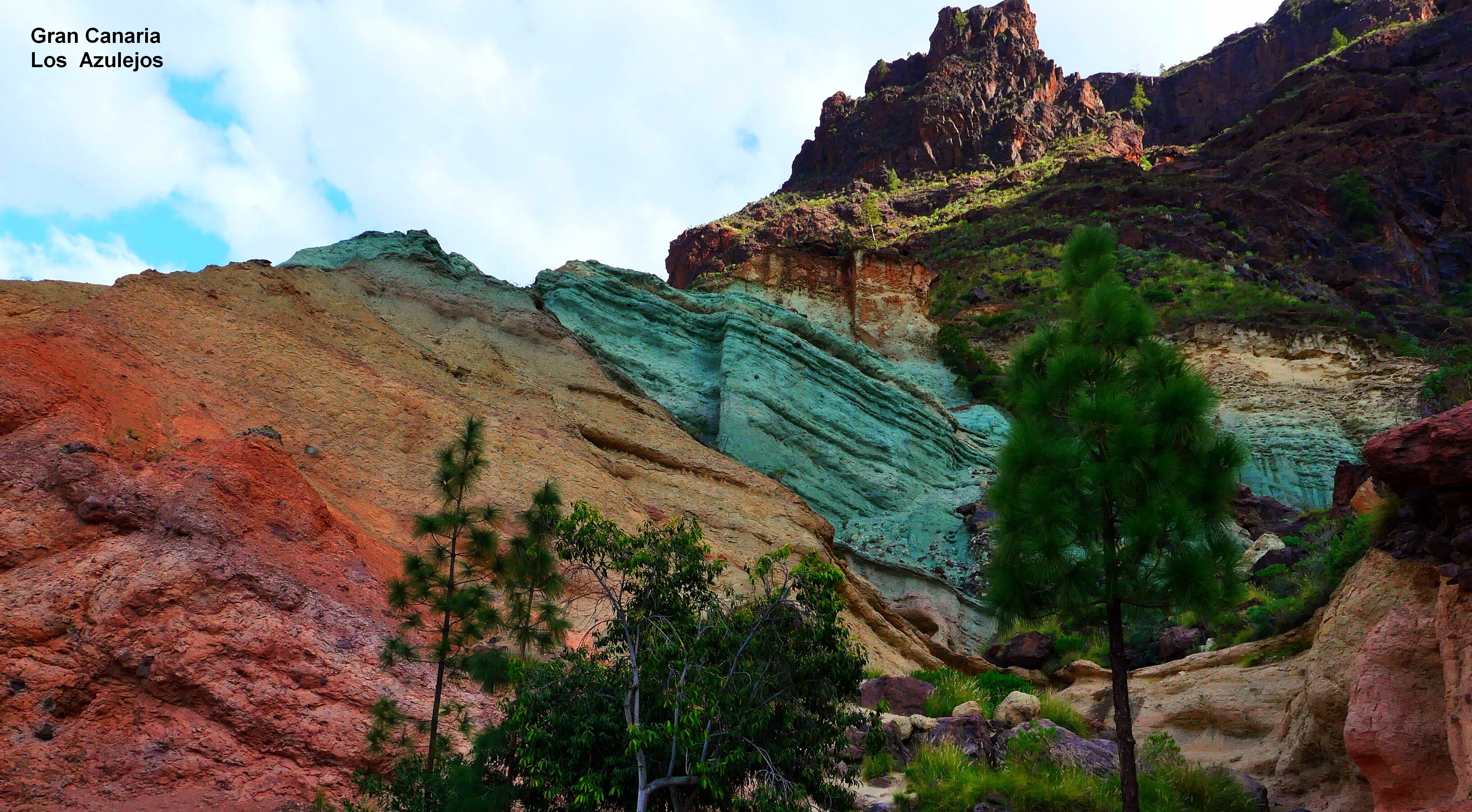
Los Azulejos
27.92241°N
-15.72620°O
Mirador de Tasartico
27.93864°N
-15.76087°O
Mirador El Balcón
28.01947°N
-15.78528°O
La Aldea de San Nicolas
27.98569°N
-15.78202°O
Mirador del Molino
27.99251°N
-15.69428°O
Artenara
28.01957°N
-15.64673°O
Agüimes
27.90663°N
-15.44628°O
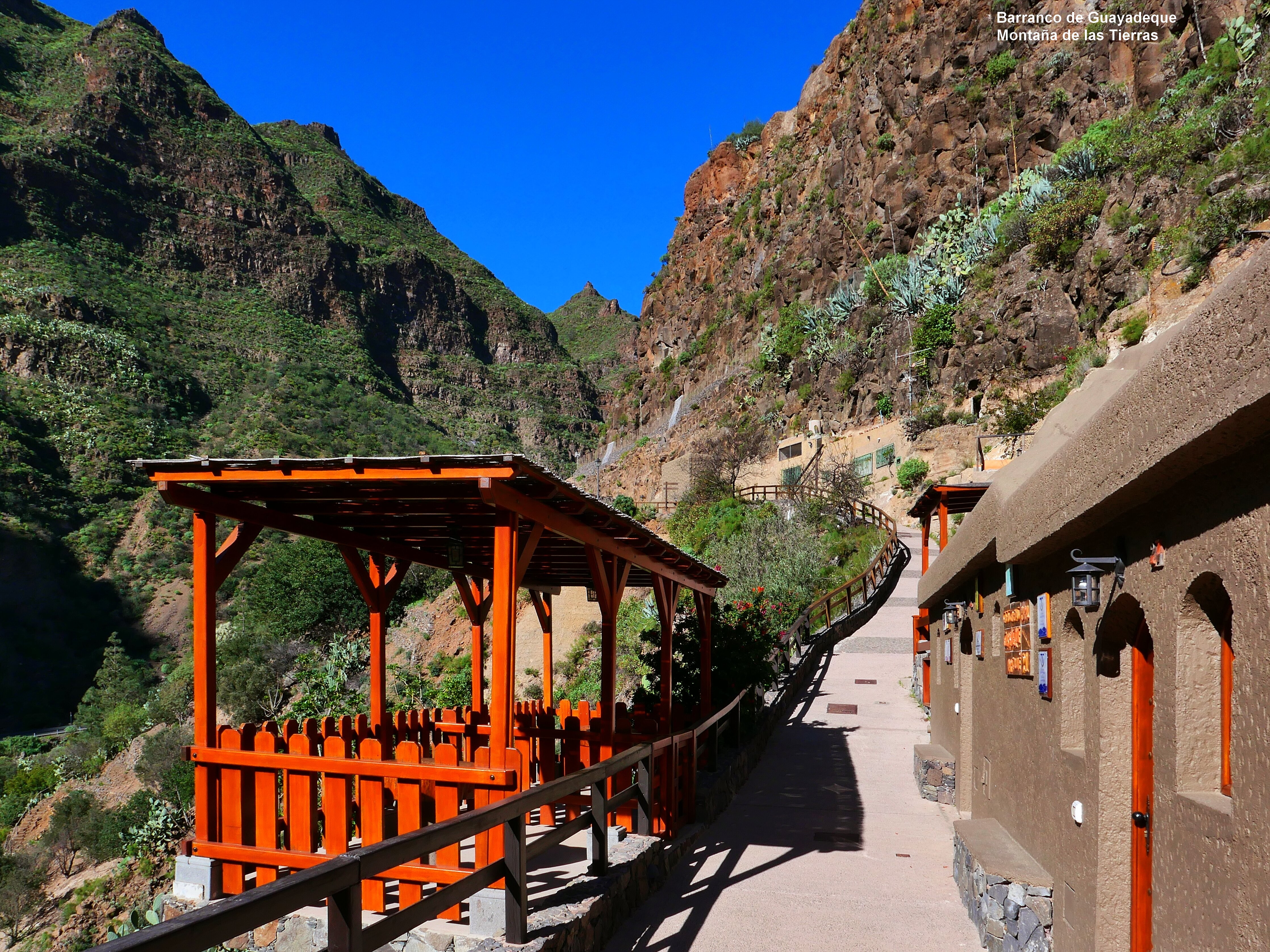
Barranco de Guayadeque
27.93521°N
-15.51222°O
Santa Lucia de Tirajana
27.91181°N
-15.54135°O
Pico de Bandama
28.03751°N
-15.45780°O
Caldera de Bandama (schmiedeeisernes Tor)
28.03558°N
-15.45988°O
Teror
28.05928°N
-15.54780°O
Arucas
28.11908°N
-15.52477°O
Link zu GPS-special
Unfortunately, it can also happen that the navigation system knows coordinates, but the input option is hidden somewhere around the umpteenth submenu.
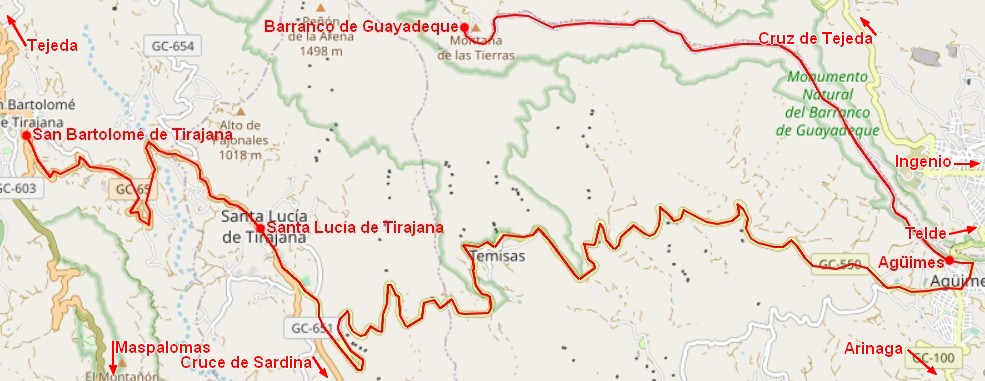
Car route 3
How to get there: Head east on the GC-1 towards the airport and at Arinaga continue on the GC-100 to Agüimes.
Route 3
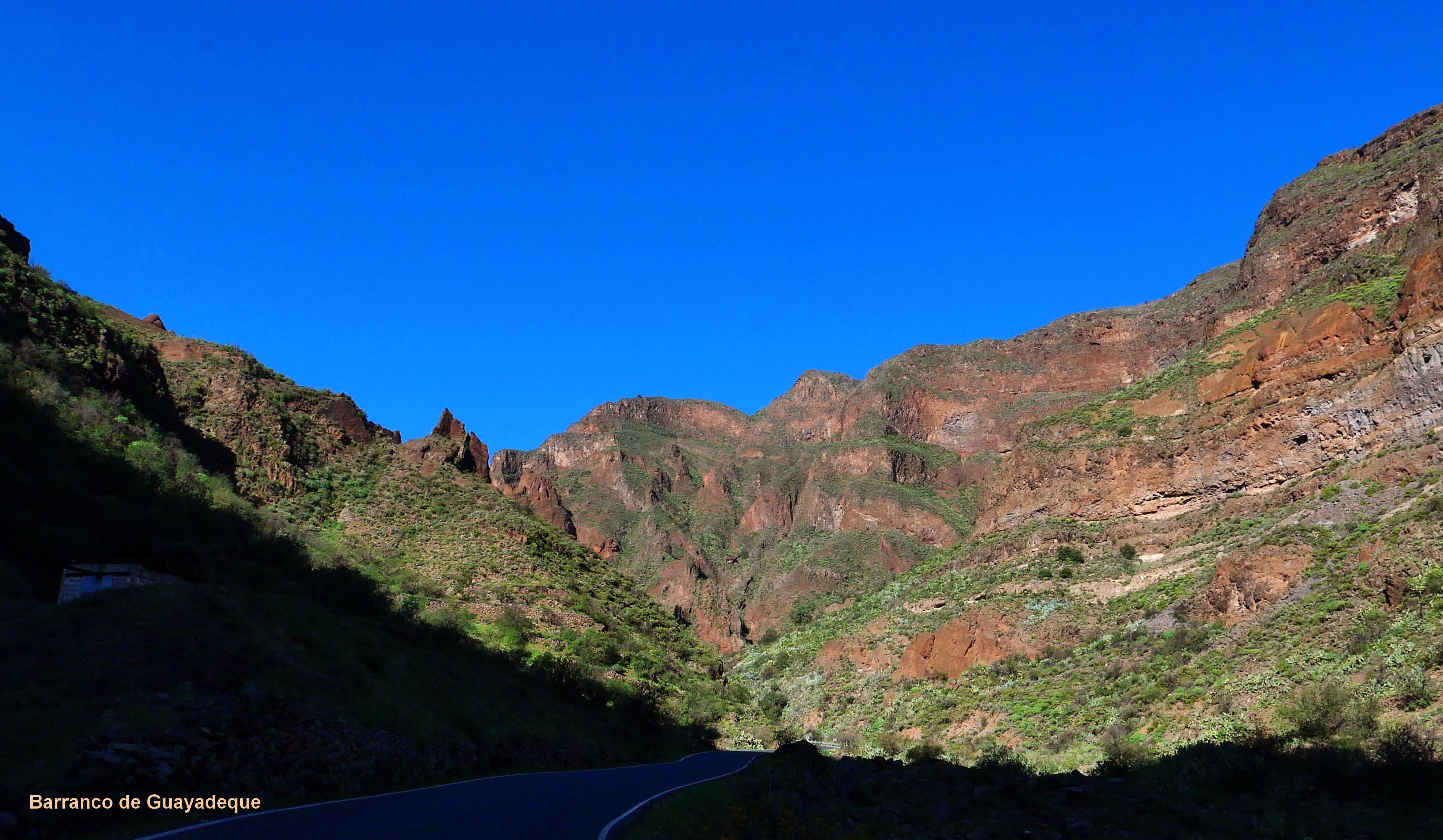
Agüimes, Barranco de Guayadeque, Montaña las Terras, Cuevas Bermejas
Agüimes
Barranco & Montaña
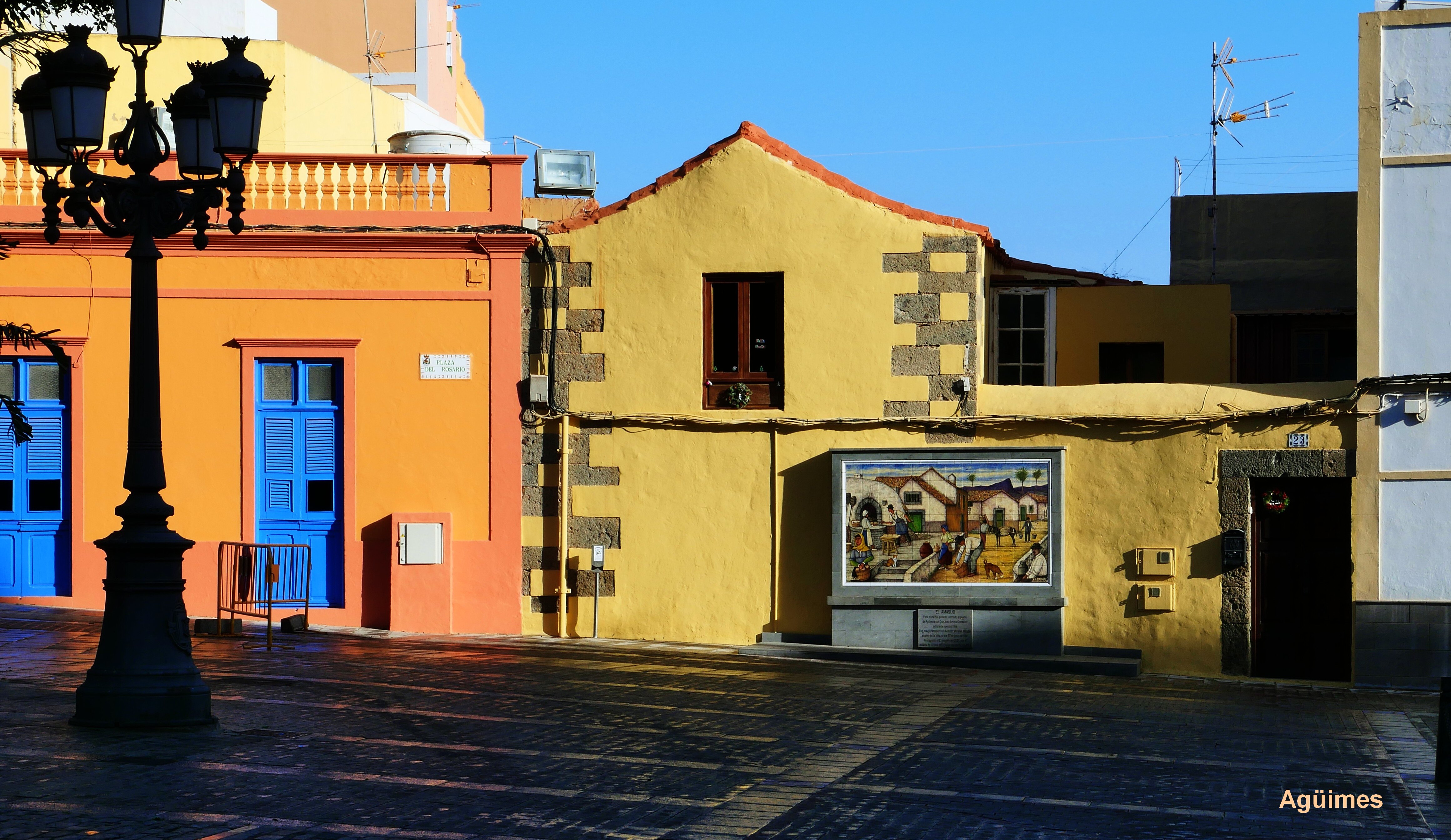
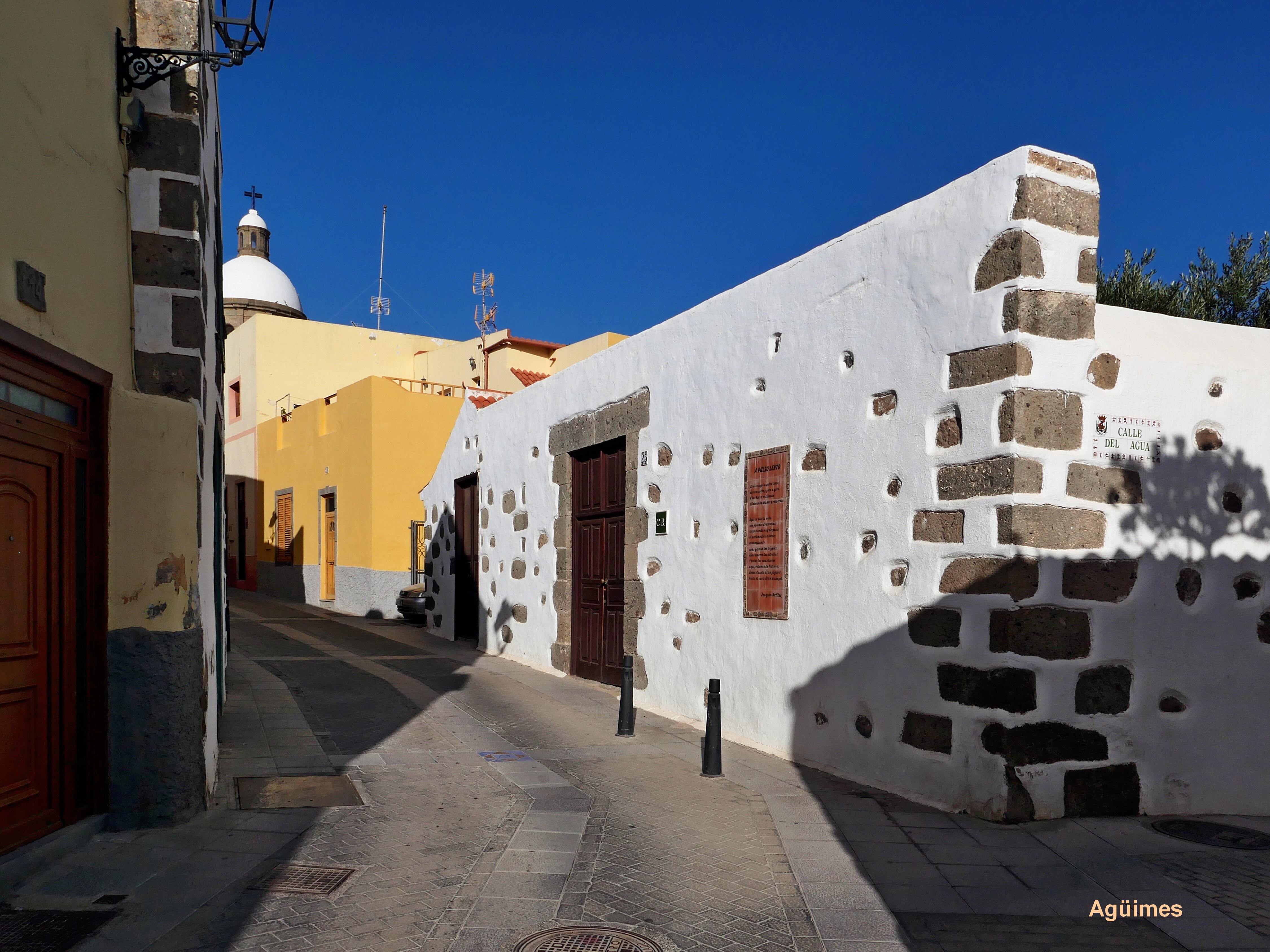
Agüimes is a place worth seeing. The pedestrian zone is optimized with regard to tourists, but the historic buildings give a good, coherent impression. The town sees itself as an "artists' village", which is evident both from the shops and from the works of art in the streets. Once you have crossed Agüimes from south to north through a narrow, inconspicuous alley, you continue on the GC-103 to the Cuevas Bermejas. It is advisable to park the car in front of the Montaña las Terras and from there walk the circular route with its wonderful views (about 30 minutes).
You drive back via Agüimes, which is ideal for a lunch break. A trip to the Barranco de las Vacas was planned. We did find this Barranco but could not climb it despite 3 described entry points (fake or advertising for a bookable excursion?). Continuation via GC-550: A really impressive mountain road not to be missed, to Santa Lucia and on to San Bartolomé.
Car route 4
Route 4a
Circular hike
Go east on the GC 1 past the airport to Telde. After Telde junction onto the GC3 and GC4. Then via the GC-801, GC-821 and GC-822 roads to Pico de Bandama. You drive by car to the summit (595 meters above sea level) and enjoy an impressive panorama from there. The highlight of the excursion is the approximately 2-hour circular hike on the rim of the crater over the Caldera de Bandama. The many ascents and descents are rewarded with magnificent views of the crater and the sea. The way into the crater is little used and probably not that spectacular. The entry points for the crater circuit are marked on the attached plan, one on the road to Pico de Bandama, one near the center (bus stop) and one just before the golf course.
From Bandama via Santa Brigida and Vega de San Mateo to Teror, Arucas
Route 4b
It was difficult to drive from Bandama to Teror without using the coastal highway. (see box GPS). The most interesting route is via the GC-15 to St. Brigida and Vega de San Matheo, then via the GC-42 to Teror. Teror is a city that is definitely worth seeing - again with a developed pedestrian zone - and a cathedral (Basilica Nuestra Señora del Pino).
The GC-43 leads to Arucas, another town worth seeing with an important cathedral: Iglesia San Juan Baptista. From there return south via the GC-3 and GC-1.
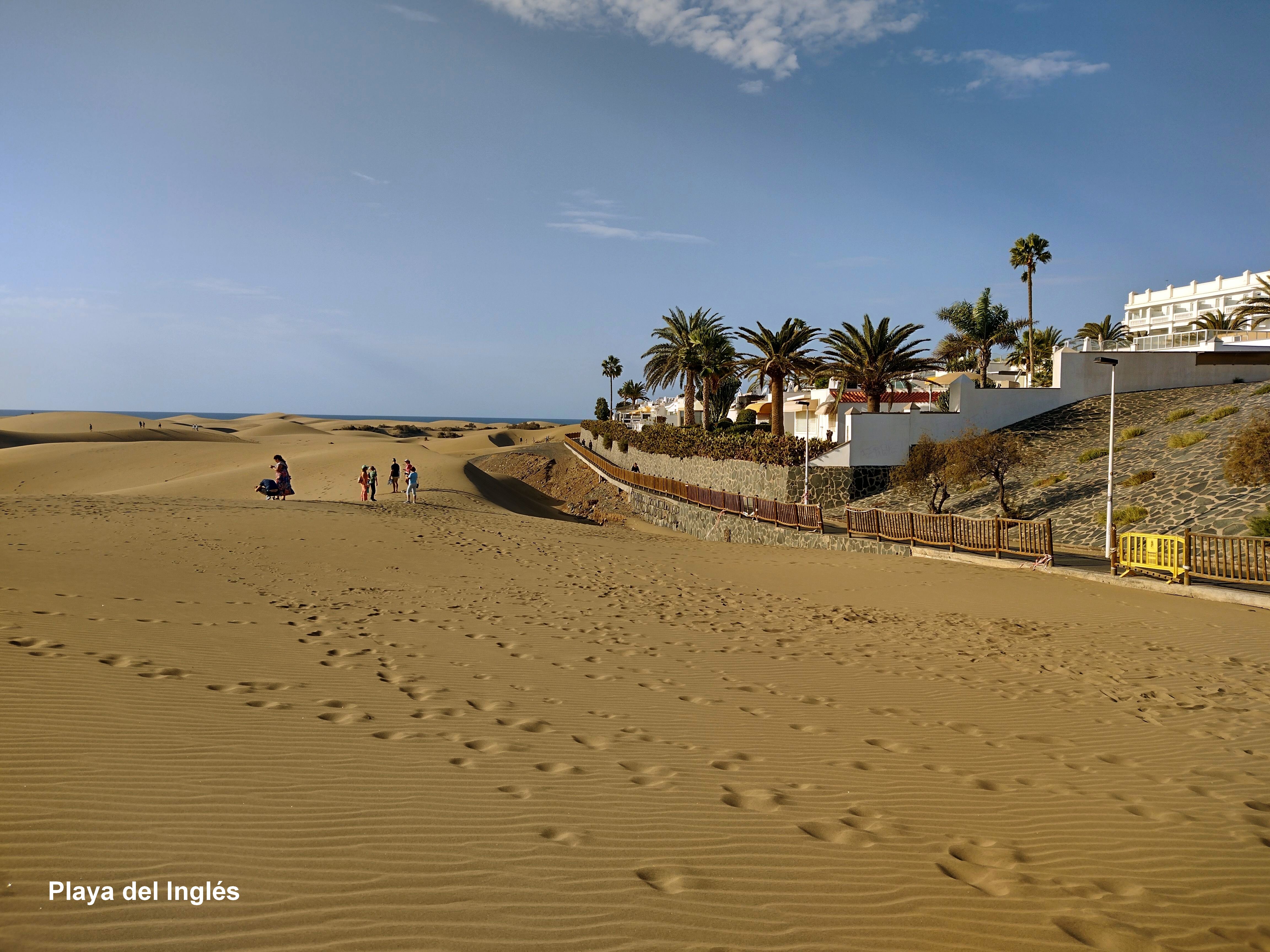
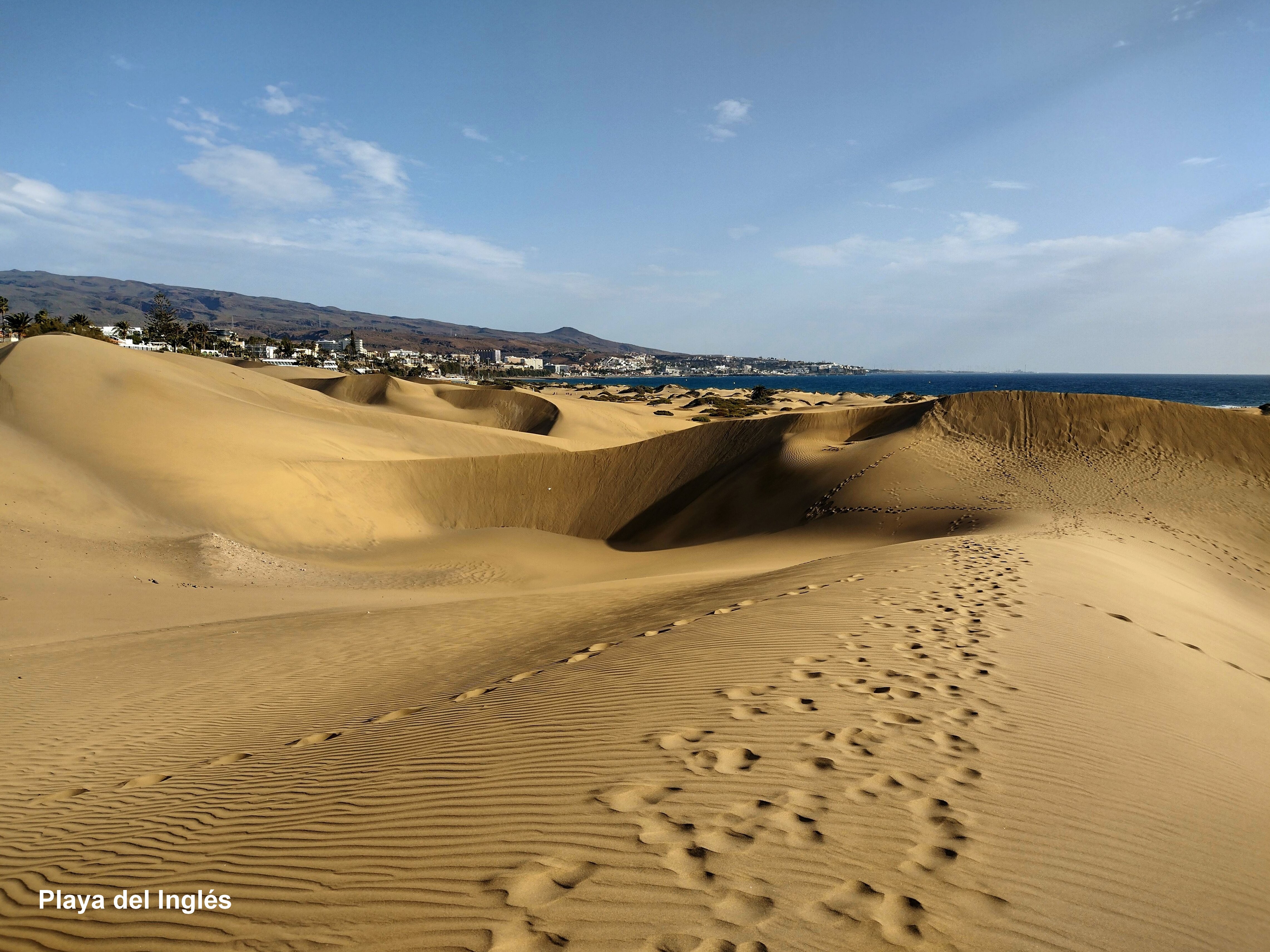
Route 5:
Hike around the dunes of Maspalomas
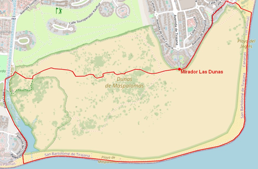
Dune walk
The hike is best started at the southern tip of Playa del Inglés heading west. One of the possible routes is marked on the plan. Going in the other direction is not recommended because the signposts are unclear.
Differences between Maspalomas and Playa del Inglés:
In Maspalomas, most of the hotel complexes are only connected to the sea by shuttle bus. In Playa del Inglés there are also numerous apartments and hotels near the sandy beach. For guests who want to eat individually, the nightlife area below the beach promenade is ideal.
Pictures
Wünsche, Anregungen, Kritiken oder einfach Kommentare an derNachdenker@gmx.at
Die Inhalte dieser Seiten wurden sorgfältig zusammengestellt,
dennoch können Fehler enthalten sein, für die der Autor keine Haftung
übernimmt.

 △
△